Difference between revisions of "2015-11-03 48 11"
imported>Klaus (aerial view from google maps) |
imported>FippeBot m (Location) |
||
| (4 intermediate revisions by one other user not shown) | |||
| Line 1: | Line 1: | ||
| + | [[Image:{{{image|2015-11-03 48 11 geohash.jpg }}}|thumb|left]] | ||
| − | |||
| − | |||
| − | |||
| − | |||
| − | |||
| − | |||
| − | |||
| − | |||
| − | |||
{{meetup graticule | {{meetup graticule | ||
| lat=48 | | lat=48 | ||
| Line 30: | Line 22: | ||
== Expedition == | == Expedition == | ||
| − | + | Everything was as easy as planned. | |
| + | |||
| + | I left work and arrived around 17:40 at the subway station. | ||
| + | I walked 5-10 minutes to the hash, while it already was completly dark. | ||
| + | The hash was on the park between two big houses. | ||
| + | As I left directly from work, I got a new achievement: Formal Attire! | ||
== Tracklog == | == Tracklog == | ||
| Line 36: | Line 33: | ||
== Photos == | == Photos == | ||
| − | |||
| − | |||
| − | |||
<gallery perrow="5"> | <gallery perrow="5"> | ||
Image:2015-11-03 48 11 googlearieal.png | aerial view from google maps | Image:2015-11-03 48 11 googlearieal.png | aerial view from google maps | ||
| + | Image:2015-11-03 48 11 proof.jpg | Proof (2m!) | ||
| + | Image:2015-11-03 48 11 geohash.jpg | View from Geohash in the dark | ||
| + | Image:2015-11-03 48 11 formal attire.jpg | In theory, this should be a picture proofing the location and the formal attire. In practice, it's just pixel mishmash. | ||
</gallery> | </gallery> | ||
| Line 47: | Line 44: | ||
<!-- Add any achievement ribbons you earned below, or remove this section --> | <!-- Add any achievement ribbons you earned below, or remove this section --> | ||
| − | |||
| − | + | {{land geohash | |
| + | | latitude = 48 | ||
| + | | longitude = 11 | ||
| + | | date = 2015-11-03 | ||
| + | | name = [[User:Klaus|Klaus]] | ||
| + | }} | ||
| + | {{Public transport geohash | ||
| + | | latitude = 48 | ||
| + | | longitude = 11 | ||
| + | | date = 2015-11-03 | ||
| + | | busline = S5 | ||
| + | | name = [[User:Klaus|Klaus]] | ||
| + | }} | ||
| + | {{Formal attire | ||
| + | | latitude = 48 | ||
| + | | longitude = 11 | ||
| + | | date = 2015-11-03 | ||
| + | | name = [[User:Klaus|Klaus]] | ||
| + | }} | ||
| + | {{Last man standing | ||
| + | | gender = man | ||
| + | | latitude = 48 | ||
| + | | longitude = 11 | ||
| + | | date = 2015-11-03 | ||
| + | | name = [[User:Klaus|Klaus]] | ||
| + | }} | ||
| − | |||
[[Category:Expeditions]] | [[Category:Expeditions]] | ||
| − | |||
[[Category:Expeditions with photos]] | [[Category:Expeditions with photos]] | ||
| − | + | ||
| − | |||
| − | |||
| − | |||
| − | |||
[[Category:Coordinates reached]] | [[Category:Coordinates reached]] | ||
| − | + | {{location|DE|BY|M|city=true}} | |
| − | |||
| − | |||
| − | |||
| − | |||
| − | |||
| − | |||
| − | |||
| − | |||
| − | |||
| − | |||
| − | |||
| − | |||
| − | |||
| − | |||
| − | |||
| − | |||
| − | |||
Latest revision as of 05:40, 15 August 2019

| Tue 3 Nov 2015 in 48,11: 48.1184062, 11.6262111 geohashing.info google osm bing/os kml crox |
Location
Haldenseestraße, München
Participants
Plans
The algorithm has mercy: After my failed expedition on Sunday I get a second chance just 2km next to the other one, and this time definitely accessible! Even better, it is directly next to the subway station, so I don't have to walk much! I'm planning to arrive there at around 17:30.
Expedition
Everything was as easy as planned.
I left work and arrived around 17:40 at the subway station. I walked 5-10 minutes to the hash, while it already was completly dark. The hash was on the park between two big houses. As I left directly from work, I got a new achievement: Formal Attire!
Tracklog
none this time
Photos
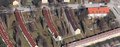
aerial view from google maps
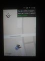
Proof (2m!)
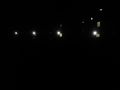
View from Geohash in the dark

In theory, this should be a picture proofing the location and the formal attire. In practice, it's just pixel mishmash.


Achievements
Klaus earned the Land geohash achievement
|
Klaus earned the Public transport geohash achievement
|
Klaus earned the Formal attire achievement
|
Klaus earned the Last man standing achievement
|