Difference between revisions of "2016-05-04 39 -77"
From Geohashing
imported>Mckaysalisbury (→Expedition) |
imported>FippeBot m (Location) |
||
| (5 intermediate revisions by one other user not shown) | |||
| Line 1: | Line 1: | ||
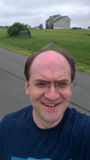
| − | [[Image: | + | [[Image:2016-05-04 39 -77 Looking SE.jpg|thumb|left]] |
{{meetup graticule | {{meetup graticule | ||
| Line 23: | Line 23: | ||
== Expedition == | == Expedition == | ||
I took the poster, and drew a crude map on the back, and I left. I went up route 7, got off on the 704 to Colonial, then took that to Bettis, and that to Rambling Farm Dr. I looked around and found a few landmarks and took a [https://photosynth.net/view.aspx?cid=8416265c-631d-4d52-9ecc-144273f5d822 spherical photo stitch]. | I took the poster, and drew a crude map on the back, and I left. I went up route 7, got off on the 704 to Colonial, then took that to Bettis, and that to Rambling Farm Dr. I looked around and found a few landmarks and took a [https://photosynth.net/view.aspx?cid=8416265c-631d-4d52-9ecc-144273f5d822 spherical photo stitch]. | ||
| − | |||
| − | |||
| − | |||
== Photos == | == Photos == | ||
| Line 32: | Line 29: | ||
--> | --> | ||
<gallery perrow="5"> | <gallery perrow="5"> | ||
| + | Image:2016-05-04 39 -77 Looking SW.jpg | The camera looking in the SW direction (with guy with stupid grin) | ||
| + | Image:2016-05-04 39 -77 Looking SE.jpg | The camera looking in the SE direction (with guy with stupid grin) | ||
| + | Image:2016-05-04 39 -77 Looking NW.jpg | The camera looking in the NW direction (with guy with stupid grin) | ||
| + | Image:2016-05-04 39 -77 Google.png | Google's image of the area | ||
| + | Image:2016-05-04 39 -77 Bing.png | Bing's image of the area | ||
| + | Image:2016-05-04 39 -77 Crude.jpg | My crude map drawn on the back of the poster. | ||
</gallery> | </gallery> | ||
== Achievements == | == Achievements == | ||
{{#vardefine:ribbonwidth|800px}} | {{#vardefine:ribbonwidth|800px}} | ||
| − | + | {{No_batteries_geohash | latitude = 39 | longitude = -77 | date = 2016-05-04 | name = [[User:Mckaysalisbury|McKay]] ([[User talk:Mckaysalisbury|talk]]) | image = 2016-05-04 39 -77 Crude.jpg}} | |
| − | |||
| − | [[ | ||
| − | |||
| − | [[ | ||
| − | |||
| − | |||
[[Category:Expeditions]] | [[Category:Expeditions]] | ||
| − | |||
[[Category:Expeditions with photos]] | [[Category:Expeditions with photos]] | ||
| − | |||
[[Category:Expedition without GPS]] | [[Category:Expedition without GPS]] | ||
| − | |||
| − | |||
| − | |||
[[Category:Coordinates reached]] | [[Category:Coordinates reached]] | ||
| − | + | {{location|US|VA|LD}} | |
| − | |||
| − | |||
| − | |||
| − | |||
| − | |||
| − | |||
| − | |||
| − | |||
| − | |||
| − | |||
| − | |||
| − | |||
| − | |||
| − | |||
| − | |||
| − | |||
Latest revision as of 01:48, 7 August 2019
| Wed 4 May 2016 in 39,-77: 39.1440569, -77.6638713 geohashing.info google osm bing/os kml crox |
Location
On Rambling Farm Dr. Near Hamilton, VA
Participants
Plans
- 10:20 AM - Hmm, I think I'll head out there. 2 Hour drive for my first time in the graticule? I'll think about it over breakfast.
- 11:50 AM - I'm going. I'll be there in about an hour. I'm going to try for No Batteries Geohash. Should be easy enough with the poster, and a couple of notes on the back. McKay (talk) 15:52, 4 May 2016 (UTC)
Expedition
I took the poster, and drew a crude map on the back, and I left. I went up route 7, got off on the 704 to Colonial, then took that to Bettis, and that to Rambling Farm Dr. I looked around and found a few landmarks and took a spherical photo stitch.
Photos
Achievements
McKay (talk) earned the No Batteries Geohash Achievement
|


