Difference between revisions of "2017-03-11 51 13"
imported>Danatar (backbone, report will follow) |
imported>FippeBot m (Location) |
||
| (2 intermediate revisions by one other user not shown) | |||
| Line 18: | Line 18: | ||
===[[User:Danatar|Danatar]]=== | ===[[User:Danatar|Danatar]]=== | ||
| − | ... | + | I started from home shortly after 3 pm, cycling through the ''Großer Garten'' and then through the Südvorstadt part of Dresden. I recognized Löbtau from another expedition and easily reached the area of the hashpoint. Instead of a school closed for the weekend I found a huge construction site as the school is currently being refurbished. There was a fence on the path directly to the hashpoint (the architect meant for the track to go to the front entrance, but his priorities were all wrong) so I planned to use the allotment garden next door to walk around the grounds. The small street I used turned out to still belong to the construction site (the entrance to the allotment garden was on the other side of a hedge as I found out) and I found myself in the back of the site. As there had been no POSTED signs I decided to continue towards the spot. There was a very new tarmac path and then a large muddy area, but I reached the corner of the school building where I knew the hashpoint was. The GPS dance was made difficult by the mud, the scaffolding and the building itself that made the GPS unit reading jump around a lot, but at 4 pm I was near enough. After taking pictures I made my way back to the bike and cycled back home with muddy shoes. In total I cycled 16 km. |
| + | |||
| + | The white balance setting of my camera was set to 'light bulb'. All the pictures from my business trips to Vienna and Rome (no hashpoints there or I would have already documented them) are off-colored as well :-( | ||
{{gallery|width=200|height=200|lines=2 | {{gallery|width=200|height=200|lines=2 | ||
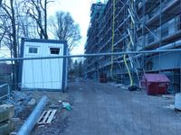
| − | |Image:2017- | + | |Image:2017-03-11_51_13_baustelle1.jpg|construction site |
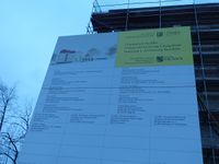
| − | |Image:2017- | + | |Image:2017-03-11_51_13_baustellenschild.jpg|"here be renovation" |
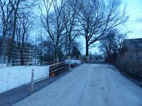
| − | |Image:2017- | + | |Image:2017-03-11_51_13_near.jpg|almost there? |
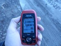
| − | |Image:2017- | + | |Image:2017-03-11_51_13_gps.jpg|GPS |
| − | |Image:2017- | + | |Image:2017-03-11_51_13_hp.jpg|Coordinates reached at 4 pm |
| − | |Image:2017- | + | |Image:2017-03-11_51_13_spot.jpg|the hashpoint |
| − | |Image:2017- | + | |Image:2017-03-11_51_13_baustelle2.jpg|construction site |
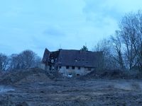
| − | |Image:2017- | + | |Image:2017-03-11_51_13_ruine.jpg|the next house over also needs work |
}} | }} | ||
| Line 35: | Line 37: | ||
===tracklog=== | ===tracklog=== | ||
| − | + | [http://www.mygpsfiles.com/app/#https://www.dropbox.com/sh/l38ubdidvmv439v/AABJHIyrxo9yZ_XbWfemMrqMa/2017/2017-03-11_51_13-triton.gpx triton tracklog] | |
[[Category:Expeditions]] | [[Category:Expeditions]] | ||
| Line 41: | Line 43: | ||
[[Category:Coordinates reached]] | [[Category:Coordinates reached]] | ||
[[Category:Danatar]] | [[Category:Danatar]] | ||
| + | {{location|DE|SN|DD}} | ||
Latest revision as of 02:14, 16 August 2019
| Sat 11 Mar 2017 in Dresden: 51.0352229, 13.6818387 geohashing.info google osm bing/os kml crox |
Location
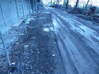
Today's location is at the corner of the Naußlitz elementary school building. The school is currently being renovated with the ground a big muddy construction site.
Country: Germany; state: Sachsen (Saxony, EU:DE:SN); district: Dresden; Ortsamt: Cotta; Stadtteil: Naußlitz.
Weather: clouded, about 9-10 °C
Expedition
Danatar
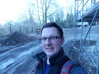
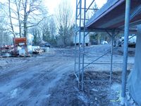
I started from home shortly after 3 pm, cycling through the Großer Garten and then through the Südvorstadt part of Dresden. I recognized Löbtau from another expedition and easily reached the area of the hashpoint. Instead of a school closed for the weekend I found a huge construction site as the school is currently being refurbished. There was a fence on the path directly to the hashpoint (the architect meant for the track to go to the front entrance, but his priorities were all wrong) so I planned to use the allotment garden next door to walk around the grounds. The small street I used turned out to still belong to the construction site (the entrance to the allotment garden was on the other side of a hedge as I found out) and I found myself in the back of the site. As there had been no POSTED signs I decided to continue towards the spot. There was a very new tarmac path and then a large muddy area, but I reached the corner of the school building where I knew the hashpoint was. The GPS dance was made difficult by the mud, the scaffolding and the building itself that made the GPS unit reading jump around a lot, but at 4 pm I was near enough. After taking pictures I made my way back to the bike and cycled back home with muddy shoes. In total I cycled 16 km.
The white balance setting of my camera was set to 'light bulb'. All the pictures from my business trips to Vienna and Rome (no hashpoints there or I would have already documented them) are off-colored as well :-(
|
