Difference between revisions of "2017-04-02 50 11"
From Geohashing
imported>Reinhard (report) |
imported>FippeBot m (Location) |
||
| Line 31: | Line 31: | ||
[[Category:Expeditions with photos]] | [[Category:Expeditions with photos]] | ||
[[Category:Coordinates reached]] | [[Category:Coordinates reached]] | ||
| + | {{location|DE|TH|EF}} | ||
Latest revision as of 02:21, 16 August 2019
| Sun 2 Apr 2017 in 50,11: 50.9407021, 11.0263431 geohashing.info google osm bing/os kml crox |
Location
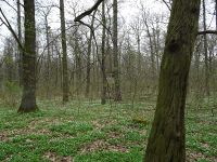
In the Steigerwald forest near Erfurt, Germany.
Participants
Expedition
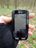
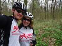
Manu and Reinhard spent their weekend in Erfurt from where it was only 3 or 4 km to the hashpoint in the Steigerwald forest. Inexplicably, both missed the hashpoint pretty much after jumping on their bicycles. Thus it took them several hours and a full lunch to reach the hashpoint after about 125 km. It was located about 60 m from the forest path, but not too hard to reach. Back home they found a shorter way ...
Tracklog
... or watch an automatic video animation of that expedition.
Photos
|


