Difference between revisions of "2017-12-30 43 -121"
From Geohashing
imported>Frogman |
imported>FippeBot m (Location) |
||
| Line 50: | Line 50: | ||
[[Category:Expeditions with photos]] | [[Category:Expeditions with photos]] | ||
[[Category:Coordinates reached]] | [[Category:Coordinates reached]] | ||
| + | {{location|US|OR|DE}} | ||
Latest revision as of 03:15, 16 August 2019

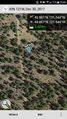
| Sat 30 Dec 2017 in 43,-121: 43.8608989, -121.5437437 geohashing.info google osm bing/os kml crox |
Location
Off of a small forest road near Sunriver, Oregon.
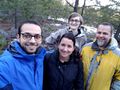
Participants
Plans
Alex came over today, and the hashpoint was astonishingly close. Time for a geohash expedition!
Expedition
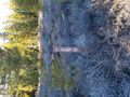
It was a pretty easy expedition! We drove about 8 minutes and pulled off on a small forest service road. We probably could have driven to the hashpoint, but the road was bumpy and muddy and we were hoping for a short walk to enjoy the day, so we walked the kilometer or so to the hashpoint instead.
Photos
The forest road sign.
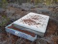
Please don't dump your trash in the forest folks
Made it!
Grins
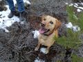
Dog grins
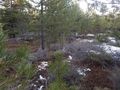
The hashpoint
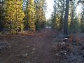
Walking back


