Difference between revisions of "2018-02-01 49 8"
imported>DODO (Created page with "{{subst:Expedition |lat = 49 |lon = 8 |date = 2018-02-01 }}") |
imported>Fippe m (fix) |
||
| (5 intermediate revisions by 2 users not shown) | |||
| Line 20: | Line 20: | ||
== Location == | == Location == | ||
<!-- where you've surveyed the hash to be --> | <!-- where you've surveyed the hash to be --> | ||
| + | A muddy field between Oftersheim and Heidelberg. | ||
== Participants == | == Participants == | ||
<!-- who attended: If you link to your wiki user name in this section, your expedition will be picked up by the various statistics generated for geohashing. You may use three tildes ~ as a shortcut to automatically insert the user signature of the account you are editing with. | <!-- who attended: If you link to your wiki user name in this section, your expedition will be picked up by the various statistics generated for geohashing. You may use three tildes ~ as a shortcut to automatically insert the user signature of the account you are editing with. | ||
--> | --> | ||
| + | [[User:DODO|DODO]] | ||
== Plans == | == Plans == | ||
<!-- what were the original plans --> | <!-- what were the original plans --> | ||
| + | Go there by bull on my way home from the office. | ||
== Expedition == | == Expedition == | ||
<!-- how it all turned out. your narrative goes here. --> | <!-- how it all turned out. your narrative goes here. --> | ||
| + | Well, I made up plans in the office and just started at quarter to 5. After a 12 KM ride along well known streets and bike lanes I had to turn right into a muddy path next to the hash-field. After 200 m I stopped and had just to walk into the fresh ploughed field. The farm was quite near and I didn't want to stay to long. I just took some pictures and a minute after I entered the field I was back at my bull and continued my way home. On the way I bought some meet and reached home 2 minutes to six, just in time to hurry to the beverage shop next door. | ||
== Tracklog == | == Tracklog == | ||
<!-- if your GPS device keeps a log, you may post a link here --> | <!-- if your GPS device keeps a log, you may post a link here --> | ||
| − | + | [https://www.komoot.de/tour/26668520 28 KM by bull] | |
== Photos == | == Photos == | ||
<!-- Insert pictures between the gallery tags using the following format: | <!-- Insert pictures between the gallery tags using the following format: | ||
| Line 39: | Line 43: | ||
--> | --> | ||
<gallery perrow="5"> | <gallery perrow="5"> | ||
| + | Image:2018-02-01_49_8-1.jpg|the hash is near this muddy road... | ||
| + | Image:2018-02-01_49_8-2.jpg|in this muddy field | ||
| + | Image:2018-02-01_49_8-3.jpg|view to the west | ||
| + | Image:2018-02-01_49_8-4.jpg|the east | ||
| + | Image:2018-02-01_49_8-5.jpg|and the hasher | ||
</gallery> | </gallery> | ||
| + | unfortnately I lost the screenshot of the proof, but you can check the tracklog. | ||
== Achievements == | == Achievements == | ||
| Line 45: | Line 55: | ||
<!-- Add any achievement ribbons you earned below, or remove this section --> | <!-- Add any achievement ribbons you earned below, or remove this section --> | ||
| − | + | {{land geohash | |
| − | + | | latitude = 49 | |
| − | + | | longitude = 8 | |
| − | + | | date = 2018-02-01 | |
| − | + | | name = DODO | |
| − | + | }} | |
| − | |||
| − | |||
| − | |||
| − | |||
| − | |||
| − | |||
| − | |||
[[Category:Expeditions]] | [[Category:Expeditions]] | ||
| − | |||
| − | |||
| − | |||
| − | |||
| − | |||
| − | |||
| − | |||
[[Category:Coordinates reached]] | [[Category:Coordinates reached]] | ||
| − | + | {{location|DE|BW|HD|city=true}} | |
| − | |||
| − | |||
| − | |||
| − | |||
| − | |||
| − | |||
| − | |||
| − | |||
| − | |||
| − | |||
| − | |||
| − | |||
| − | |||
| − | |||
| − | |||
| − | |||
| − | |||
Latest revision as of 18:59, 11 August 2019
| Thu 1 Feb 2018 in 49,8: 49.3674101, 8.6210650 geohashing.info google osm bing/os kml crox |
Location
A muddy field between Oftersheim and Heidelberg.
Participants
Plans
Go there by bull on my way home from the office.
Expedition
Well, I made up plans in the office and just started at quarter to 5. After a 12 KM ride along well known streets and bike lanes I had to turn right into a muddy path next to the hash-field. After 200 m I stopped and had just to walk into the fresh ploughed field. The farm was quite near and I didn't want to stay to long. I just took some pictures and a minute after I entered the field I was back at my bull and continued my way home. On the way I bought some meet and reached home 2 minutes to six, just in time to hurry to the beverage shop next door.
Tracklog
Photos
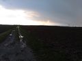
the hash is near this muddy road...
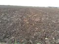
in this muddy field
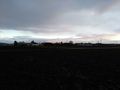
view to the west
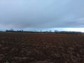
the east

and the hasher


unfortnately I lost the screenshot of the proof, but you can check the tracklog.
Achievements
DODO earned the Land geohash achievement
|