Difference between revisions of "2018-02-11 50 12"
imported>Danatar ([live] Reached) |
(→tracklog) |
||
| (2 intermediate revisions by 2 users not shown) | |||
| Line 1: | Line 1: | ||
| − | + | {{meetup graticule | |
| − | |||
| − | |||
| − | |||
| − | |||
| − | |||
| − | |||
| − | |||
| − | |||
| − | |||
| − | {{meetup graticule | ||
| lat=50 | | lat=50 | ||
| lon=12 | | lon=12 | ||
| date=2018-02-11 | | date=2018-02-11 | ||
| − | }} | + | | graticule_name=Chemnitz |
| + | | graticule_link=Chemnitz, Germany | ||
| + | }}__NOTOC__ | ||
| + | == Location == | ||
| − | + | Today's location is in a small birch forest next to the ''Niedercrinitz picnic stop'' along the Autobahn A72 near Zwickau. | |
| − | |||
| − | + | Country: Germany; state: Sachsen (Saxony, EU:DE:SN); district: Zwickau; municipality: Wilkau-Haßlau | |
| − | |||
| − | + | Weather: clouded, 0-2 °C | |
| − | |||
| − | |||
| − | |||
| − | |||
| − | == Expedition == | + | == Expedition== |
| − | + | ===[[User:Danatar|Danatar]]=== | |
| + | I had been in Würzburg since Wednesday, both for a conference (Thursday till Saturday) and to meet friends. For the return trip to Dresden I noticed that the hashpoint was right next to the Autobahn. At first I thought about doing the usual "leave Autobahn at exit N, go to hashpoint, get back on the Autobahn at exit N+1" routine but then I thought "why all that detour instead of a short walk?". After an uneventful 2.5 hours of driving I stopped at the picnic stop. Then I walked along the fence that runs all along the Autobahn until I reached on of the doors that are in that fence. I hadn't been sure if those doors were usually locked but when I reached one I wasn't, so they are only for keeping out animals (mostly deer) as I presumed, not for keeping in humans. I walked over to the underpass and on the other side of the Autobahn entered the small birch forest. | ||
| + | The hashpoint was found quickly: | ||
*Reached -- [[User:Danatar|Danatar]] ([[User talk:Danatar|talk]]) [http://www.openstreetmap.org/?lat=50.65087720&lon=12.49201650&zoom=16&layers=B000FTF @50.6509,12.4920] 13:03, 11 February 2018 (GMT+01:00) | *Reached -- [[User:Danatar|Danatar]] ([[User talk:Danatar|talk]]) [http://www.openstreetmap.org/?lat=50.65087720&lon=12.49201650&zoom=16&layers=B000FTF @50.6509,12.4920] 13:03, 11 February 2018 (GMT+01:00) | ||
| − | |||
| − | |||
| − | + | I quickly took pictures while my hands became colder and colder in the frosty air, then walked back to the car in order for another 1.5 hours of driving. | |
| − | |||
| − | |||
| − | |||
| − | |||
| − | |||
| − | |||
| − | |||
| − | |||
| − | + | {{gallery|width=200|height=200|lines=2 | |
| − | + | |Image:2018-02-11_50_12_rastplatz.jpg|Niedercrinitz picnic stop | |
| − | + | |Image:2018-02-11_50_12_tor.jpg|door to leave the picnic stop area | |
| + | |Image:2018-02-11_50_12_bruecke.jpg|crossing to the other side of the Autobahn | ||
| + | |Image:2018-02-11_50_12_wald.jpg|almost there | ||
| + | |Image:2018-02-11_50_12_gps.jpg|GPS | ||
| + | |Image:2018-02-11_50_12_hp.jpg|coordinates reached | ||
| + | |Image:2018-02-11_50_12_spot.jpg|the hashpoint | ||
| + | |Image:2018-02-11_50_12_pano.jpg|panorama | ||
| + | |Image:2018-02-11_50_12_weiter.jpg|continueing here | ||
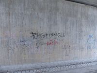
| + | |Image:2018-02-11_50_12_purgatory.jpg|under the bridge there was this satanist-themed graffiti... | ||
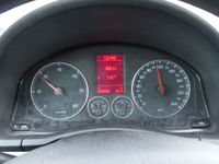
| + | |Image:2018-02-11_50_12_kmstand.jpg|... similar to my car's mileage a few minutes earlier. | ||
| + | }} | ||
| − | |||
| − | |||
| − | |||
| − | |||
| − | |||
| − | + | ===tracklog=== | |
| + | [https://www.dropbox.com/sh/l38ubdidvmv439v/AABLfX5xjAsk_gdgIveuOn_ba/2018/2018-02-11_50_12-s4mini.gpx phone tracklog] | ||
| − | |||
[[Category:Expeditions]] | [[Category:Expeditions]] | ||
| − | |||
[[Category:Expeditions with photos]] | [[Category:Expeditions with photos]] | ||
| − | |||
| − | |||
| − | |||
| − | |||
| − | |||
[[Category:Coordinates reached]] | [[Category:Coordinates reached]] | ||
| − | + | [[Category:Danatar]] | |
| − | + | {{location|DE|SN|Z}} | |
| − | |||
| − | |||
| − | |||
| − | |||
| − | |||
| − | |||
| − | |||
| − | |||
| − | |||
| − | |||
| − | [[Category: | ||
| − | |||
| − | |||
| − | |||
| − | |||
| − | |||
Latest revision as of 17:34, 7 February 2021
| Sun 11 Feb 2018 in Chemnitz: 50.6508774, 12.4920210 geohashing.info google osm bing/os kml crox |
Location
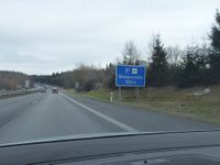
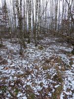
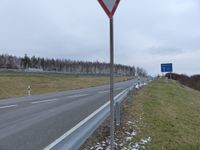
Today's location is in a small birch forest next to the Niedercrinitz picnic stop along the Autobahn A72 near Zwickau.
Country: Germany; state: Sachsen (Saxony, EU:DE:SN); district: Zwickau; municipality: Wilkau-Haßlau
Weather: clouded, 0-2 °C
Expedition
Danatar
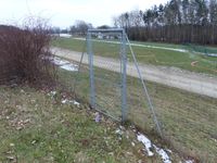
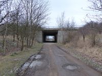
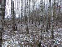
I had been in Würzburg since Wednesday, both for a conference (Thursday till Saturday) and to meet friends. For the return trip to Dresden I noticed that the hashpoint was right next to the Autobahn. At first I thought about doing the usual "leave Autobahn at exit N, go to hashpoint, get back on the Autobahn at exit N+1" routine but then I thought "why all that detour instead of a short walk?". After an uneventful 2.5 hours of driving I stopped at the picnic stop. Then I walked along the fence that runs all along the Autobahn until I reached on of the doors that are in that fence. I hadn't been sure if those doors were usually locked but when I reached one I wasn't, so they are only for keeping out animals (mostly deer) as I presumed, not for keeping in humans. I walked over to the underpass and on the other side of the Autobahn entered the small birch forest.
The hashpoint was found quickly:
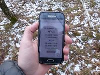
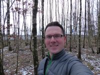
- Reached -- Danatar (talk) @50.6509,12.4920 13:03, 11 February 2018 (GMT+01:00)
I quickly took pictures while my hands became colder and colder in the frosty air, then walked back to the car in order for another 1.5 hours of driving.
|
