Difference between revisions of "2018-04-01 50 11"
imported>Reinhard (report) |
imported>FippeBot m (Location) |
||
| (One intermediate revision by one other user not shown) | |||
| Line 23: | Line 23: | ||
{{gallery|width=200|height=200|lines=1 | {{gallery|width=200|height=200|lines=1 | ||
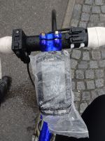
|Image:20180401-50N11E-01.jpg|Coordinates reached? | |Image:20180401-50N11E-01.jpg|Coordinates reached? | ||
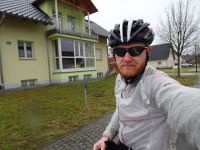
| − | |Image: | + | |Image:20180401-50N11E-02.jpg|Reinhard at the hashpoint.}} |
[[Category:Expeditions]] | [[Category:Expeditions]] | ||
[[Category:Expeditions with photos]] | [[Category:Expeditions with photos]] | ||
[[Category:Coordinates reached]] | [[Category:Coordinates reached]] | ||
| + | {{location|DE|TH|SON}} | ||
Latest revision as of 02:56, 7 August 2019
| Sun 1 Apr 2018 in 50,11: 50.3474098, 11.1452802 geohashing.info google osm bing/os kml crox |
Location
On a residential road in Hönbach (Sonneberg), Germany.
Participants
Expedition
As this hashpoint was only a marathon distance away from where I stayed over the Easter holidays, I thought this one is definitely too close to miss! My last expedition had been over half a year ago and it was not raining (though rain was predicted for the later afternoon and the roads were still wet from the morning), reasons enough to set out for this one. I had tailwind for the way there, but rain and soft hail started 5 km before reaching the hash and prevailed for about half an hour to leave me wet and cold for the way back against the wind. To protect the camera from water damage I only took two quick and blurred photos (you have to accept the tracklog for proof) and got back on almost the same way.
Tracklog
Photos
|

