Difference between revisions of "2018-06-26 51 13"
imported>Oisín (Expedition) |
imported>FippeBot m (Location) |
||
| (4 intermediate revisions by 2 users not shown) | |||
| Line 11: | Line 11: | ||
== Location == | == Location == | ||
| − | The hash is located in Dresden, in the Ostragehege right besides the tramway bridge. | + | The hash is located in Dresden, in the Ostragehege right besides the tramway bridge. The area is part of a floodway. |
| − | Country: Germany; state: Sachsen (Saxony, EU:DE:SN); | + | Country: Germany; state: Sachsen (Saxony, EU:DE:SN); district: Dresden; Ortsamt: Altstadt; Stadtteil: Friedrichstadt |
Weather: 20°C, partially cloudy | Weather: 20°C, partially cloudy | ||
| + | |||
== Participants == | == Participants == | ||
| − | [[User:Oisín|Oisín]] ([[ | + | * [[User:Oisín|Oisín]] ([[User_talk:Oisín|talk]]) |
| + | * [[User:Danatar|Danatar]] | ||
| + | |||
== Expedition == | == Expedition == | ||
| − | === [[User:Oisín|Oisín]] ([[ | + | === [[User:Oisín|Oisín]] ([[User_talk:Oisín|talk]]) === |
I did a small detour on my way home late after work along the river Elbe straigth to the hashpoint near the sporting areas in the Ostragehege. It was a warm evening and there were not many people around, just a few on the soccer pitches and the gymnastic area. After taking a few pictures I continued my way home. | I did a small detour on my way home late after work along the river Elbe straigth to the hashpoint near the sporting areas in the Ostragehege. It was a warm evening and there were not many people around, just a few on the soccer pitches and the gymnastic area. After taking a few pictures I continued my way home. | ||
| − | |||
| − | |||
| − | |||
| − | |||
| − | |||
| − | |||
| − | |||
| − | |||
<gallery perrow="5"> | <gallery perrow="5"> | ||
Image:2018-06-26_51_13_self.jpg | Oisín at the hash point | Image:2018-06-26_51_13_self.jpg | Oisín at the hash point | ||
Image:2018-06-26 51 13 bridge.jpg | Looking north | Image:2018-06-26 51 13 bridge.jpg | Looking north | ||
</gallery> | </gallery> | ||
| + | |||
| + | |||
| + | ===[[User:Danatar|Danatar]]=== | ||
| + | I was going to a barbeque that wasn't far from the hashpoint, about 1 km, on the other side of the Elbe though. Usually I would have crossed the Elbe at the Albert bridge and then cycled along the Elbe to the place but the hashpoint led me along a different route. Cycling along the Elbe on the southern side of the river brought me to the city center, then I continued along the river until I was at the Marienbrücke (Mary bridge). From there it was just along a very straight street that went along the Ostragehege sporting area until I reached the hashpoint. The spot itself was easy to find on the open meadow. I didn't stay long, returning to the Marienbrücke and crossing the Elbe there before reaching the barbeque where the grill was already burning. | ||
| + | |||
| + | |||
| + | {{gallery|width=200|height=200|lines=2 | ||
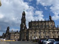
| + | |Image:2018-06-26_51_13_d_hofkirche.jpg|[[wikipedia:Dresden Cathedral|Dresden Cathedral]] | ||
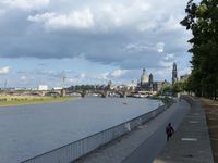
| + | |Image:2018-06-26_51_13_d_elbe.jpg|looking along the Elbe to the Dresden city center | ||
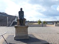
| + | |Image:2018-06-26_51_13_d_dostojewskij.jpg|Dostoevsky statue | ||
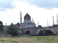
| + | |Image:2018-06-26_51_13_d_yenidze.jpg|[[wikipedia:Yenidze|Yenidze]], former cigarette factory from 1909 in oriental style | ||
| + | |Image:2018-06-26_51_13_d_weg.jpg| | ||
| + | |Image:2018-06-26_51_13_d_near1.jpg|not far now | ||
| + | |Image:2018-06-26_51_13_d_near2.jpg|almost there | ||
| + | |Image:2018-06-26_51_13_d_gps.jpg|GPS | ||
| + | |Image:2018-06-26_51_13_d_hp.jpg|coordinates reached! | ||
| + | |Image:2018-06-26_51_13_d_spot.jpg|hashpoint with Scott | ||
| + | |Image:2018-06-26_51_13_d_pano.jpg|panorama | ||
| + | }} | ||
| + | |||
| + | [http://www.mygpsfiles.com/app/#https://www.dropbox.com/sh/l38ubdidvmv439v/AAAS6QAkvgJ3jxXCZfKHtuP7a/2018/2018-06-26_51_13-triton.gpx Triton tracklog] | ||
| + | |||
== Achievements == | == Achievements == | ||
| Line 46: | Line 63: | ||
| latitude = 51 | | latitude = 51 | ||
| longitude = 13 | | longitude = 13 | ||
| − | | date = | + | | date = 2018-06-26 |
| name = Oisín | | name = Oisín | ||
| distance = 11 km | | distance = 11 km | ||
| Line 55: | Line 72: | ||
[[Category:Expeditions with photos]] | [[Category:Expeditions with photos]] | ||
[[Category:Coordinates reached]] | [[Category:Coordinates reached]] | ||
| + | [[Category:Danatar]] | ||
| + | {{location|DE|SN|DD}} | ||
Latest revision as of 03:46, 16 August 2019
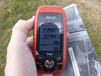
| Tue 26 Jun 2018 in 51,13: 51.0655139, 13.7164614 geohashing.info google osm bing/os kml crox |
Location
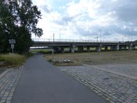
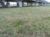
The hash is located in Dresden, in the Ostragehege right besides the tramway bridge. The area is part of a floodway.
Country: Germany; state: Sachsen (Saxony, EU:DE:SN); district: Dresden; Ortsamt: Altstadt; Stadtteil: Friedrichstadt
Weather: 20°C, partially cloudy
Participants
Expedition
Oisín (talk)
I did a small detour on my way home late after work along the river Elbe straigth to the hashpoint near the sporting areas in the Ostragehege. It was a warm evening and there were not many people around, just a few on the soccer pitches and the gymnastic area. After taking a few pictures I continued my way home.
Danatar
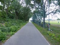
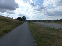
I was going to a barbeque that wasn't far from the hashpoint, about 1 km, on the other side of the Elbe though. Usually I would have crossed the Elbe at the Albert bridge and then cycled along the Elbe to the place but the hashpoint led me along a different route. Cycling along the Elbe on the southern side of the river brought me to the city center, then I continued along the river until I was at the Marienbrücke (Mary bridge). From there it was just along a very straight street that went along the Ostragehege sporting area until I reached the hashpoint. The spot itself was easy to find on the open meadow. I didn't stay long, returning to the Marienbrücke and crossing the Elbe there before reaching the barbeque where the grill was already burning.
|
Achievements
Oisín earned the Bicycle geohash achievement
|


