Difference between revisions of "2018-07-07 62 30"
imported>Pastori (Created page with "{{meetup graticule | lat=62 | lon=30 | date=2018-07-07 }} __NOTOC__ == Location == Ilomantsi, Kivilahti, Sormusenaho. The point lies among densely planted fir trees on treac...") |
m (per Renaming Proposal) |
||
| (3 intermediate revisions by 3 users not shown) | |||
| Line 46: | Line 46: | ||
== Achievements == | == Achievements == | ||
| − | {{ | + | |
| + | {{Graticule unlocked | ||
| latitude = 62 | | latitude = 62 | ||
| longitude = 30 | | longitude = 30 | ||
| Line 53: | Line 54: | ||
| image = 2018-07-07 62 30DSC 0805 1500px.jpg | | image = 2018-07-07 62 30DSC 0805 1500px.jpg | ||
}} | }} | ||
| + | |||
| + | |||
{{Minesweeper geohash | graticule = 62,30 | ranknumber = 6 | sw = true | nw = true | n = true | ne = true | e = true | w = true | name = [[User:Pastori|Pastori]]}} | {{Minesweeper geohash | graticule = 62,30 | ranknumber = 6 | sw = true | nw = true | n = true | ne = true | e = true | w = true | name = [[User:Pastori|Pastori]]}} | ||
| + | |||
{{land geohash | latitude = 62 | longitude = 30 | date = 2018-07-07 | name = Pastori | image = 2018-07-07 62 30DSC 0805 1500px.jpg | {{land geohash | latitude = 62 | longitude = 30 | date = 2018-07-07 | name = Pastori | image = 2018-07-07 62 30DSC 0805 1500px.jpg | ||
}} | }} | ||
| + | |||
| + | [[Category:Expeditions]] | ||
| + | [[Category:Expeditions with photos]] | ||
| + | [[Category:Coordinates reached]] | ||
| + | {{location|FI|13}} | ||
Latest revision as of 04:54, 20 March 2024
| Sat 7 Jul 2018 in 62,30: 62.9389184, 30.4879861 geohashing.info google osm bing/os kml crox |
Location
Ilomantsi, Kivilahti, Sormusenaho. The point lies among densely planted fir trees on treacherous ground.
Participants
- Pastori
- The Wife
Expedition
In honor of Tour de France starting today, Pastori decided to do a little tour de Pielinen (a lake in the region) of his own. A good additional booster was an unvisited graticule very near their home, about 150 km away.
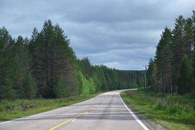
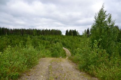
So, off they went after breakfast at 8:18 am in semi-cloudy weather, with a packed lunch of course. They drove along the eastern side of lake Pielinen on quiet, well maintained paved roads which slowly turned to dirt roads, still in good condition. After 161.1 km though they had to stop because the condition of the road started to be too poor for Pastori's little Yaris. There was still 500 m to the road so they parked by the side of the road, donned their boots and went off on foot. It was easy to walk on the dirt road, even if there were hills, up until there was 150 m to the point. At this point they had to head into the forest amidst pine cones, ripening bilberries and mosquitoes. The point was easy to find and they reached it with an accuracy of 2.788 m. After a quick photo they headed straight back because they had accumulated way too many little companions. Lunch was had while walking back to the car. Altogether they walked for 2.020 km.
Happy with having conquered a new graticule and his own activity Pastori rewarded himself and Wife with coffee and Danishes in the nearest coffee house 14 km away. On the way home they took a little detour by the south side of the lake and up the west side to see |Koli, the highest Arctic fell around their part of Finland, 347 m from sea level.
As is typical for most Finns, especially during summer, Pastori and Wife were already in their own sauna bathing their mosquito bites at the time of the official hashpoint meet up time.
The totals for the day: 6 h 38 min, 348.8 km by car, 2.02 km walking, two cups of coffee with Danishes 4 euros, ice cream, licorice and soda 5.45 euros, 300 m of stairs to get up to Koli.
Photos
Achievements
Pastori earned the Graticule Unlocked Achievement
|
Pastori achieved level 6 of the Minesweeper Geohash achievement
|
Pastori earned the Land geohash achievement
|


