Difference between revisions of "2018-07-25 50 11"
imported>Reinhard (report 2) |
imported>FippeBot m (Location) |
||
| (2 intermediate revisions by one other user not shown) | |||
| Line 16: | Line 16: | ||
[[2018-07-24_50_11|Start reading here ...]] | [[2018-07-24_50_11|Start reading here ...]] | ||
| − | I calculated, I could reach the 2nd hashpoint around midnight, so the time was right to | + | I calculated, I could reach the 2nd hashpoint around midnight, so the time was right to continue my double expedition. Just one and a half minute before midnight I dismounted from my bike at the edge of the hash field near Mertendorf. It was almost 500 m from here, but though the field was cropped already the ground was too uneven for relaxed roadcycling, so I had to walk, enjoying the warm summer night (still around 16 °C) and being lit by an almost full moon. Reached the spot without any problems at 00:08 and walked on for another 470 m till I reached the road between Wetzdorf and Poppendorf. From there it was a relaxing ride down to the Saale valley and back home. |
| − | |||
== Tracklog == | == Tracklog == | ||
| Line 29: | Line 28: | ||
}} | }} | ||
| − | + | == Awards == | |
{{consecutive geohash | count=2 | latitude=50 | longitude=11 | date=2018-07-24 | name=Reinhard }} | {{consecutive geohash | count=2 | latitude=50 | longitude=11 | date=2018-07-24 | name=Reinhard }} | ||
| Line 35: | Line 34: | ||
[[Category:Expeditions with photos]] | [[Category:Expeditions with photos]] | ||
[[Category:Coordinates reached]] | [[Category:Coordinates reached]] | ||
| + | {{location|DE|TH|SHK}} | ||
Latest revision as of 03:53, 16 August 2019
| Wed 25 Jul 2018 in 50,11: 50.9993062, 11.7808446 geohashing.info google osm bing/os kml crox |
Location
In the middle of a field between Wetzdorf, Poppendorf, Mertendorf - Thuringia, Germany.
Participants
Expedition
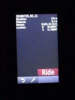
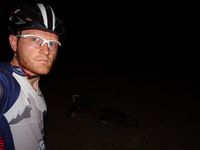
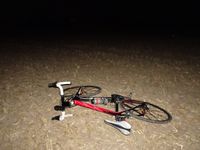
I calculated, I could reach the 2nd hashpoint around midnight, so the time was right to continue my double expedition. Just one and a half minute before midnight I dismounted from my bike at the edge of the hash field near Mertendorf. It was almost 500 m from here, but though the field was cropped already the ground was too uneven for relaxed roadcycling, so I had to walk, enjoying the warm summer night (still around 16 °C) and being lit by an almost full moon. Reached the spot without any problems at 00:08 and walked on for another 470 m till I reached the road between Wetzdorf and Poppendorf. From there it was a relaxing ride down to the Saale valley and back home.
Tracklog
Photos
|
Awards
Reinhard earned the Consecutive geohash achievement
|


