Difference between revisions of "2018-11-25 51 2"
imported>FelixTheCat (Created page with "{{subst:Expedition |lat = 51 |lon = 2 |date = 2018-11-25 }}") |
m (per Renaming Proposal) |
||
| (4 intermediate revisions by 2 users not shown) | |||
| Line 1: | Line 1: | ||
| − | |||
| − | |||
| − | |||
| − | |||
| − | |||
| − | |||
| − | |||
| − | |||
| − | |||
| − | |||
{{meetup graticule | {{meetup graticule | ||
| lat=51 | | lat=51 | ||
| Line 14: | Line 4: | ||
| date=2018-11-25 | | date=2018-11-25 | ||
}} | }} | ||
| − | |||
| − | |||
__NOTOC__ | __NOTOC__ | ||
== Location == | == Location == | ||
| − | + | A small forest in Koekelare, West Flanders province, Belgium. | |
== Participants == | == Participants == | ||
| − | + | [[User:FelixTheCat|FelixTheCat]] ([[User talk:FelixTheCat|talk]]) | |
| − | |||
| − | == | + | == Expedition == |
| − | + | Today there was a reachable geohash in 51,2, a graticule I hadn't visited yet but which is still relatively nearby. It's quite rare that there are reachable hashpoints in this graticule, since it's about 90% water. Yesterday's hash was, amazingly, also on dry land, but inside a residential building. Today's was in a small forest in the middle of a rural area south of Bruges. I researched several ways to get to the hash. I could drive there in about 2.5 hours, but I didn't really feel like driving today. Public transport wasn't really an option given the point's remoteness (relatively speaking), so in the end I settled for a train trip to Bruges, then getting a rental bike and cycling the remaining 20 km or so. | |
| + | |||
| + | I left Delft on the 8:01 train to Breda, where I changed onto the international train to Antwerp. I then changed again to get to Ghent, and once more to get to Bruges. There I discovered that the bike rental place that I had planned on using was closed, even though they mentioned on their own website that they were open today! Luckily there was another one in the city centre that was open, and I got myself a rather simple bike that was really more suited to short trips around the city rather than the marathon that I had in mind. Nevertheless, I set off and rode about 28 km through nice rural Belgian landscapes. Once at the forest I parked the bike and walked the last 50 metres through thorny undergrowth to reach the hash. | ||
| + | |||
| + | Then I had to go back, and after a few kilometres I began to feel cold and tired. The bike's chain was dry and rusty, the frame was too small for me, and the lowest gear didn't work, so cycling uphill became a bit of a challenge. I had planned to do some sightseeing in Bruges or Ghent afterwards, but upon reaching the bike rental place I was feeling so cold, tired and hungry that I just wanted to get something to eat and give my feet a rest. Since it was already around 15:45 I decided to call it a day and went back to the train station. I rode the same four trains to get back to Delft. According to my GPS, the total round-trip distance for today was 506 km. | ||
| − | + | This is the first successful expedition in 51,2. What is perhaps even more interesting is that this finally makes a solid link between Britain and mainland Europe on the Geohashing World Map, on the day the EU and the UK agreed on the terms of the Brexit deal. We still love you Britain! | |
| − | |||
| − | + | [[File:2018-11-25 51 2 FelixTheCat 21.PNG]] | |
| − | |||
== Photos == | == Photos == | ||
| − | |||
| − | |||
| − | |||
<gallery perrow="5"> | <gallery perrow="5"> | ||
| + | Image:2018-11-25 51 2 FelixTheCat 1.JPG | Train #1: Delft to Breda. | ||
| + | Image:2018-11-25 51 2 FelixTheCat 2.JPG | Train #2: Breda to Antwerp. | ||
| + | Image:2018-11-25 51 2 FelixTheCat 3.JPG | Train #3: Antwerp to Ghent. | ||
| + | Image:2018-11-25 51 2 FelixTheCat 4.JPG | Train #4: Ghent to Bruges. | ||
| + | Image:2018-11-25 51 2 FelixTheCat 5.JPG | My ride for the last stretch. | ||
| + | Image:2018-11-25 51 2 FelixTheCat 6.JPG | The landscape was nice. The roads, not so much. The weather was cold and humid. | ||
| + | Image:2018-11-25 51 2 FelixTheCat 7.JPG | Entering the village of Koekelare. | ||
| + | Image:2018-11-25 51 2 FelixTheCat 8.JPG | The entrance to the forest. | ||
| + | Image:2018-11-25 51 2 FelixTheCat 9.JPG | Some interesting wood carving. | ||
| + | Image:2018-11-25 51 2 FelixTheCat 10.JPG | The hash is right ahead. | ||
| + | Image:2018-11-25 51 2 FelixTheCat 11.JPG | Found it after a bit of dancing (always tricky in wooded areas). | ||
| + | Image:2018-11-25 51 2 FelixTheCat 13.PNG | GPS proof. | ||
| + | Image:2018-11-25 51 2 FelixTheCat 12.JPG | Lloyd celebrating. | ||
| + | Image:2018-11-25 51 2 FelixTheCat 14.JPG | A weird puddle nearby. Looks like an impact crater of some sort. | ||
| + | Image:2018-11-25 51 2 FelixTheCat 15.JPG | After a long ride back, finally returned the bike. | ||
| + | Image:2018-11-25 51 2 FelixTheCat 16.JPG | I had some "dirty fries" on the winter fair in Bruges. | ||
| + | Image:2018-11-25 51 2 FelixTheCat 17.JPG | The train back to Ghent. | ||
| + | Image:2018-11-25 51 2 FelixTheCat 18.JPG | On to Antwerp. | ||
| + | Image:2018-11-25 51 2 FelixTheCat 19.JPG | Towards Breda. | ||
| + | Image:2018-11-25 51 2 FelixTheCat 20.JPG | And back to Delft. | ||
</gallery> | </gallery> | ||
== Achievements == | == Achievements == | ||
{{#vardefine:ribbonwidth|800px}} | {{#vardefine:ribbonwidth|800px}} | ||
| − | + | {{Graticule unlocked | |
| − | + | | latitude = 51 | |
| − | + | | longitude = 2 | |
| − | + | | date = 2018-11-25 | |
| − | + | | name = [[User:FelixTheCat|FelixTheCat]] ([[User talk:FelixTheCat|talk]]) | |
| − | + | }} | |
| − | |||
| − | |||
| − | |||
| − | |||
| − | |||
| − | |||
| − | |||
| − | |||
| − | |||
| − | |||
[[Category:Expeditions]] | [[Category:Expeditions]] | ||
| − | |||
[[Category:Expeditions with photos]] | [[Category:Expeditions with photos]] | ||
| − | |||
| − | |||
| − | |||
| − | |||
| − | |||
[[Category:Coordinates reached]] | [[Category:Coordinates reached]] | ||
| − | + | {{location|BE|VWV}} | |
| − | |||
| − | |||
| − | |||
| − | |||
| − | |||
| − | |||
| − | |||
| − | |||
| − | |||
| − | |||
| − | |||
| − | |||
| − | |||
| − | |||
| − | |||
| − | |||
| − | |||
Latest revision as of 04:52, 20 March 2024
| Sun 25 Nov 2018 in 51,2: 51.0774251, 2.9502000 geohashing.info google osm bing/os kml crox |
Location
A small forest in Koekelare, West Flanders province, Belgium.
Participants
Expedition
Today there was a reachable geohash in 51,2, a graticule I hadn't visited yet but which is still relatively nearby. It's quite rare that there are reachable hashpoints in this graticule, since it's about 90% water. Yesterday's hash was, amazingly, also on dry land, but inside a residential building. Today's was in a small forest in the middle of a rural area south of Bruges. I researched several ways to get to the hash. I could drive there in about 2.5 hours, but I didn't really feel like driving today. Public transport wasn't really an option given the point's remoteness (relatively speaking), so in the end I settled for a train trip to Bruges, then getting a rental bike and cycling the remaining 20 km or so.
I left Delft on the 8:01 train to Breda, where I changed onto the international train to Antwerp. I then changed again to get to Ghent, and once more to get to Bruges. There I discovered that the bike rental place that I had planned on using was closed, even though they mentioned on their own website that they were open today! Luckily there was another one in the city centre that was open, and I got myself a rather simple bike that was really more suited to short trips around the city rather than the marathon that I had in mind. Nevertheless, I set off and rode about 28 km through nice rural Belgian landscapes. Once at the forest I parked the bike and walked the last 50 metres through thorny undergrowth to reach the hash.
Then I had to go back, and after a few kilometres I began to feel cold and tired. The bike's chain was dry and rusty, the frame was too small for me, and the lowest gear didn't work, so cycling uphill became a bit of a challenge. I had planned to do some sightseeing in Bruges or Ghent afterwards, but upon reaching the bike rental place I was feeling so cold, tired and hungry that I just wanted to get something to eat and give my feet a rest. Since it was already around 15:45 I decided to call it a day and went back to the train station. I rode the same four trains to get back to Delft. According to my GPS, the total round-trip distance for today was 506 km.
This is the first successful expedition in 51,2. What is perhaps even more interesting is that this finally makes a solid link between Britain and mainland Europe on the Geohashing World Map, on the day the EU and the UK agreed on the terms of the Brexit deal. We still love you Britain!

Photos
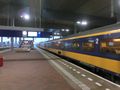
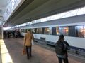
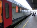
Train #1: Delft to Breda.
Train #2: Breda to Antwerp.
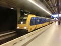
Train #3: Antwerp to Ghent.
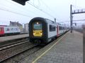
Train #4: Ghent to Bruges.
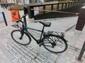
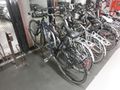
My ride for the last stretch.
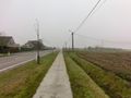
The landscape was nice. The roads, not so much. The weather was cold and humid.
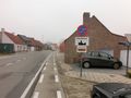
Entering the village of Koekelare.
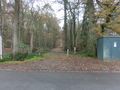
The entrance to the forest.
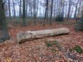
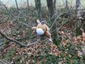
Some interesting wood carving.
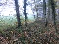
The hash is right ahead.
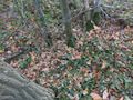
Found it after a bit of dancing (always tricky in wooded areas).
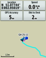
GPS proof.
Lloyd celebrating.
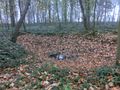
A weird puddle nearby. Looks like an impact crater of some sort.
After a long ride back, finally returned the bike.
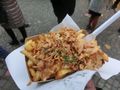
I had some "dirty fries" on the winter fair in Bruges.
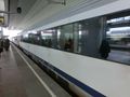
The train back to Ghent.
On to Antwerp.

Towards Breda.
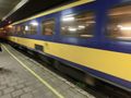
And back to Delft.


Achievements
FelixTheCat (talk) earned the Graticule Unlocked Achievement
|