Difference between revisions of "2019-03-01 50 11"
From Geohashing
imported>Reinhard (report) |
imported>FippeBot m (Location) |
||
| (One intermediate revision by one other user not shown) | |||
| Line 21: | Line 21: | ||
== Photos == | == Photos == | ||
| − | {{gallery|width=200|height=200|lines= | + | {{gallery|width=200|height=200|lines=2 |
|Image:20190301-50N11E-01.jpg|Walking there. | |Image:20190301-50N11E-01.jpg|Walking there. | ||
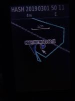
|Image:20190301-50N11E-02.jpg|Circling around the spot. | |Image:20190301-50N11E-02.jpg|Circling around the spot. | ||
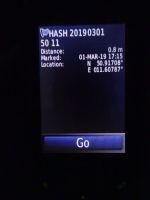
|Image:20190301-50N11E-03.jpg|Coordinates reached. | |Image:20190301-50N11E-03.jpg|Coordinates reached. | ||
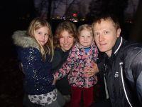
| − | |Image:20190301-50N11E-04.jpg|Group of hashers. | + | |Image:20190301-50N11E-04.jpg|Group of hashers (JenTower in the background). |
}} | }} | ||
| Line 31: | Line 31: | ||
[[Category:Expeditions with photos]] | [[Category:Expeditions with photos]] | ||
[[Category:Coordinates reached]] | [[Category:Coordinates reached]] | ||
| + | {{location|DE|TH|J}} | ||
Latest revision as of 04:33, 16 August 2019
| Fri 1 Mar 2019 in 50,11: 50.9170804, 11.6078715 geohashing.info google osm bing/os kml crox |
Location
Near a garden at the edge of the forest of Jena Kernberge, Thuringia, Germany.
Participants
Expedition
The participants could take a small detour on their way into the weekend and visit this hashpoint by a short walk at the slope of Jena's Kernberge. Unfortunately, it was already dark by the time they got there.
Photos
|


