Difference between revisions of "2019-04-06 50 11"
From Geohashing
imported>Reinhard (Created page with "{{meetup graticule | lat=50 | lon=11 | date=2019-04-06 }} <!-- edit as necessary --> __NOTOC__ == Location == On a meadow near Jena-Ziegenhain, Thuringia, Germany. == Parti...") |
imported>FippeBot m (Location) |
||
| (2 intermediate revisions by one other user not shown) | |||
| Line 22: | Line 22: | ||
== Photos == | == Photos == | ||
{{gallery|width=200|height=200|lines=1 | {{gallery|width=200|height=200|lines=1 | ||
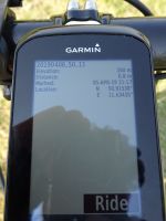
| − | |Image: | + | |Image:20190406-50N11E-01.jpg|Coordinates reached. |
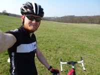
| − | |Image: | + | |Image:20190406-50N11E-02.jpg|Hash view towards Fuchsturm. |
}} | }} | ||
| Line 29: | Line 29: | ||
[[Category:Expeditions with photos]] | [[Category:Expeditions with photos]] | ||
[[Category:Coordinates reached]] | [[Category:Coordinates reached]] | ||
| + | {{location|DE|TH|J}} | ||
Latest revision as of 03:39, 7 August 2019
| Sat 6 Apr 2019 in 50,11: 50.9153836, 11.6343516 geohashing.info google osm bing/os kml crox |
Location
On a meadow near Jena-Ziegenhain, Thuringia, Germany.
Participants
Expedition
Too close to miss, nevertheless Reinhard made it a four-hour bicycle ride, visiting the hashpoint in the end.
Tracklog
Photos
|

