Difference between revisions of "2019-05-21 50 9"
From Geohashing
imported>GeorgDerReisende (new report) |
imported>GeorgDerReisende (expedition report for Bad Hersfeld) |
||
| Line 1: | Line 1: | ||
| + | [[Image:{{{image|2019-05-21 50 9 GeorgDerReisende 0001.jpg}}}|thumb|left]] | ||
| − | |||
| − | |||
| − | |||
| − | |||
| − | |||
| − | |||
| − | |||
| − | |||
| − | |||
{{meetup graticule | {{meetup graticule | ||
| lat=50 | | lat=50 | ||
| Line 19: | Line 11: | ||
== Location == | == Location == | ||
| − | + | ||
| + | The hash lay on the western side of the Großer Wehneberg at Bad Hersfeld. | ||
== Participants == | == Participants == | ||
| − | + | ||
| − | + | [[User:GeorgDerReisende|GeorgDerReisende]] | |
== Plans == | == Plans == | ||
| − | + | ||
| + | Public transport and walking. | ||
== Expedition == | == Expedition == | ||
| − | |||
| − | + | I traveled by tram, train and an Anrufsammeltaxi to Hof Wehneberg, a small settlement on the Großer Wehneberg. I walked around the hill and found the hash at a big tree beside a small street. | |
| − | |||
== Photos == | == Photos == | ||
| − | |||
| − | |||
| − | |||
<gallery perrow="5"> | <gallery perrow="5"> | ||
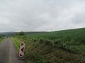
| + | 2019-05-21 50 9 GeorgDerReisende 8124.jpg | the hash tree from the distance | ||
| + | 2019-05-21 50 9 GeorgDerReisende 8127.jpg | the hash tree is near | ||
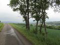
| + | 2019-05-21 50 9 GeorgDerReisende 8130.jpg | the hash tree stands on a slope | ||
| + | 2019-05-21 50 9 GeorgDerReisende 8131.jpg | the hash tree itself | ||
| + | 2019-05-21 50 9 GeorgDerReisende 8132.jpg | I wrote a marker onto the street | ||
| + | 2019-05-21 50 9 GeorgDerReisende 8133.jpg | looking north | ||
| + | 2019-05-21 50 9 GeorgDerReisende 8134.jpg | looking east | ||
| + | 2019-05-21 50 9 GeorgDerReisende 8135.jpg | looking south | ||
| + | 2019-05-21 50 9 GeorgDerReisende 8136.jpg | looking west | ||
| + | 2019-05-21 50 9 GeorgDerReisende 8137.jpg | the geohasher | ||
| + | 2019-05-21 50 9 GeorgDerReisende 8139.jpg | the junction of streets some meters south | ||
| + | 2019-05-21 50 9 GeorgDerReisende 8140.jpg | the hash from the other side | ||
</gallery> | </gallery> | ||
| + | |||
| + | I forgot to write it down: it's Geohashing Day today. | ||
== Achievements == | == Achievements == | ||
| Line 45: | Line 48: | ||
<!-- Add any achievement ribbons you earned below, or remove this section --> | <!-- Add any achievement ribbons you earned below, or remove this section --> | ||
| − | + | {{Geohashing Day | latitude = 50 | longitude = 9 | year = 2019 | coorddate = 2019-05-21 | name = GeorgDerReisende }} | |
| − | |||
| − | |||
| − | + | [[Category:Expeditions]] | |
| − | + | [[Category:Expeditions with photos]] | |
| − | |||
| − | |||
| − | |||
| − | |||
| − | |||
| − | |||
| − | |||
| − | |||
| − | |||
| − | |||
[[Category:Expedition without GPS]] | [[Category:Expedition without GPS]] | ||
| − | |||
| − | |||
| − | |||
| − | |||
| − | |||
| − | |||
| + | {{location|DE|HE|HEF}} | ||
| − | + | [[Category:Coordinates reached]] | |
| − | [[Category:Coordinates | ||
| − | |||
| − | |||
| − | |||
| − | |||
| − | |||
| − | |||
| − | |||
| − | |||
| − | |||
| − | |||
| − | |||
| − | |||
| − | |||
| − | |||
Latest revision as of 09:05, 27 May 2019

| Tue 21 May 2019 in 50,9: 50.8830994, 9.6959560 geohashing.info google osm bing/os kml crox |
Location
The hash lay on the western side of the Großer Wehneberg at Bad Hersfeld.
Participants
Plans
Public transport and walking.
Expedition
I traveled by tram, train and an Anrufsammeltaxi to Hof Wehneberg, a small settlement on the Großer Wehneberg. I walked around the hill and found the hash at a big tree beside a small street.
Photos
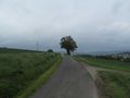
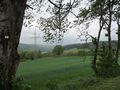
the hash tree from the distance
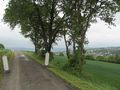
the hash tree is near
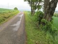
the hash tree stands on a slope
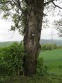
the hash tree itself
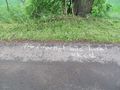
I wrote a marker onto the street
looking north
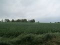
looking east
looking south
looking west
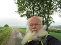
the geohasher
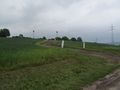
the junction of streets some meters south
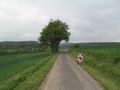
the hash from the other side


I forgot to write it down: it's Geohashing Day today.
Achievements
GeorgDerReisende earned the 2019 Geohashing Day achievement
|