Difference between revisions of "Template:Expeditions/2008-06-11"
From Geohashing
imported>Tjtrumpet2323 m (New page: <pre> West of -30°: Will be known at 09:30 EDT (13:30 UTC) on Tuesday 10 June. East of -30°: 0.553532499632, 0.398799858588 </pre>) |
imported>Tjtrumpet2323 m (Replacing page with '== {{date link|2008-06-11}} == {{:2008-06-11}}') |
||
| (5 intermediate revisions by 4 users not shown) | |||
| Line 1: | Line 1: | ||
| − | + | == {{date link|2008-06-11}} == | |
| − | + | {{:2008-06-11}} | |
| − | |||
| − | |||
Latest revision as of 14:06, 13 June 2008
Wednesday 11 June 2008
Coordinates
West of -30°: 0.465719991106, 0.726359952605
East of -30°: 0.553532499632, 0.398799858588
Expeditions
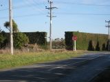
- 2008-06-11 -43 172 Christchurch, New Zealand -- Geohash was less than 20 km from uni so Evil Monkey hopped on my bike and rode out there. Didn't quite find it exactly but looking at map came within about 250 metres.
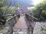
- 2008-06-11 45 -75 Ottawa/Hull, Canada -- Geohash was in the middle of a waterway out in Gatineau. Daniel Rubin biked there with Andrew and Serafino. Unfortunately, we were unable to obtain a boat, however we threw rocks at the location. As well, fate decided to put a staircase for us to use (see photos)
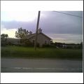
- 2008-06-11 41 -87 Richton Park, IL -- Geohash reached by YellowYoshi. A lone house/flower shop by the road (couldn't stop to find out which!)
- 2008-06-11 42 -71 Boston, MA -- Geohash was reached by Tuttleturtle42 by bike.
- 2008-06-11 31 -84 Albany, Georgia -- Geohash overflown by Robyn for the first aerial geohash achievement.
Photo Gallery
Add your own photo for Wednesday 11 June


