Difference between revisions of "2020-02-29 48 10"
TheOneRing (talk | contribs) (Created page with "{{meetup graticule | lat=48 | lon=10 | date=2020-02-29 }} == Location == The geohash is on a service raod near Türkheim. == Who Went == * TheOneRing -...") |
m (→Location) |
||
| (2 intermediate revisions by 2 users not shown) | |||
| Line 6: | Line 6: | ||
== Location == | == Location == | ||
| − | The geohash is on a service | + | The geohash is on a service road near Türkheim. |
== Who Went == | == Who Went == | ||
| Line 27: | Line 27: | ||
Image:20200229_48_10_GPS.jpg|...at the geohash | Image:20200229_48_10_GPS.jpg|...at the geohash | ||
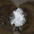
Image:20200229_48_10_Geohash.jpg|Stereographic view at the geohash, which is located on the left side | Image:20200229_48_10_Geohash.jpg|Stereographic view at the geohash, which is located on the left side | ||
| + | Image:20200229_48_10_Picnic.jpg|My small baguette roll for picnic | ||
Image:20200229_48_10_Surrounding.jpg|Panoramic view of the fields nearby | Image:20200229_48_10_Surrounding.jpg|Panoramic view of the fields nearby | ||
Image:20200229_48_10_Marterl.jpg|A Marterl (wayside cross)° | Image:20200229_48_10_Marterl.jpg|A Marterl (wayside cross)° | ||
| Line 41: | Line 42: | ||
[[Category:Expeditions with photos]] | [[Category:Expeditions with photos]] | ||
[[Category:Coordinates reached]] | [[Category:Coordinates reached]] | ||
| + | {{location|DE|BY|MN}} | ||
Latest revision as of 11:03, 2 March 2020
| Sat 29 Feb 2020 in 48,10: 48.0713524, 10.6336988 geohashing.info google osm bing/os kml crox |
Location
The geohash is on a service road near Türkheim.
Who Went
- TheOneRing - by car
The Expedition
In 2019, I took a hiatus. But with leap day 2020, I wanted to do something special again. Having done the Leap geohash achievements in 2012 and 2016, I wanted to continue the streak.
I figured the geohash was near Türkheim, a town I know quite well because my alphorn group is meeting there. Consequently, the route via autobahn was not a problem. I arrived in Türkheim around 11 o'clock, refilled the car and bought something light to eat. I parked on the area of the former train station, checked my eTrex and started to walk.
It was a nice walk of about 1km of service roads, mostly paved, so in good conditions. Before taking any pictures at the geohash, I had a little picnic by eating the baguette roll I bought. After I finished what may qualify as a brunch I took some photographs.
The service road was not very fascinating, so I took some more photos on my way back, including fields and some horses.
Finally, I went home again to go shopping for the weekend
Photos
°The text reads: Man sieht die//Wunder//in der Flur//und lobt den//Schöpfer//der Natur (roughly translated, rhyme-preserving: You see the wonders in the mead, and praise nature's Maker indeed)
Achievements
TheOneRing earned the Land geohash achievement
|
TheOneRing earned the Picnic achievement
|
TheOneRing earned the Leap geohash achievement 2020
|


