Difference between revisions of "2019-12-26 -38 143"
(Dark Ages achievement) |
m (→Participants) |
||
| Line 23: | Line 23: | ||
== Participants == | == Participants == | ||
*[[User:Felix Dance|Felix Dance]] | *[[User:Felix Dance|Felix Dance]] | ||
| − | *Ruth | + | *[[User:Ruth|Ruth]] |
== Expedition == | == Expedition == | ||
Latest revision as of 12:51, 24 June 2024
| Thu 26 Dec 2019 in -38,143: -38.6993710, 143.1595425 geohashing.info google osm bing/os kml crox |
Location
At a camping ground in Princetown, Western Victoria.
Participants
Expedition
My girlfriend Ruth and I went on a three day bushwalk along the Otways in Western Victoria. We were camping at a caravan park in Port Campbell before we started the walk and we were sitting at a brewery when I discovered the day's hash.
Ruth being sober enough to drive we walked back to camp to pick up the car and drove out along the spectacular Great Ocean Road towards the town of Princetown where the hash was. We arrived just before sunset and found the hash to be right in the middle of the town's recreation reserve - requisitioned this time of year for camping.
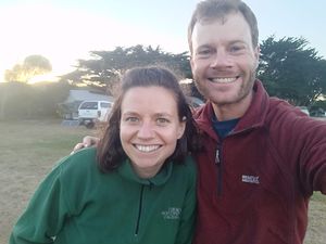
Not at all awkwardly we took photos at the exact hash-spot surrounded by summer campers. And then back into the car and back towards Campbelltown, about 20 mins away.
ALong the way home we stopped off at the 12 Apostles to watch the sunset in amongst the crowds of tourists.
The next day when we started our bushwalk we coincidentally came to within a couple of metres of the geohash. Had the hash been for the day after it would have been a contender for winning the EasyHash achievement.
Here is the route of our trip.


