Difference between revisions of "2008-06-28 47 -120"
From Geohashing
imported>PBnJ (minor comment edits, plus gallery added) |
imported>FippeBot m (Location) |
||
| (5 intermediate revisions by 4 users not shown) | |||
| Line 1: | Line 1: | ||
| + | {{meetup graticule | ||
| + | | map=<map lat="47" lon="-120" date="2008-06-28" /> | ||
| + | | lat=47 | ||
| + | | lon=-120 | ||
| + | | date=2008-06-28 | ||
| + | | graticule_name=Wenatchee | ||
| + | | graticule_link=Wenatchee, Washington}} | ||
| + | |||
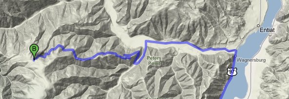
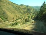
47.65811°, -120.365635° is located just below Dinkelman Ridge (near Entiat), about 200 feet off a forest service road. | 47.65811°, -120.365635° is located just below Dinkelman Ridge (near Entiat), about 200 feet off a forest service road. | ||
| Line 34: | Line 42: | ||
* [[Drag-Along Geohash]]: PBnJ enlisted Skylar and Orville, who had never heard of geohashing before but were game for a random adventure. | * [[Drag-Along Geohash]]: PBnJ enlisted Skylar and Orville, who had never heard of geohashing before but were game for a random adventure. | ||
| − | * [[No Batteries Geohash]]: Our GPS supplier fell through at the last minute, so we had to rely on GoogleMap's Terrain View and the car's trip-ometer. Would have gone the last 200 feet (off-road) with measuring string and a compass, but the straightest route was also straight up, and heavily | + | * [[No Batteries Geohash]]: Our GPS supplier fell through at the last minute, so we had to rely on GoogleMap's Terrain View and the car's trip-ometer. Would have gone the last 200 feet (off-road) with measuring string and a compass, but the straightest route was also straight up, and heavily vegetated, so we went around, and eyeballed it with just the compass. |
| − | * [[Circus Geohash]]: Orville, poi master! (Aaron also made an attempt.) We would have also tried [http://en.wikipedia.org/wiki/Slacklining | + | * [[Circus Geohash]]: Orville, poi master! (Aaron also made an attempt.) We would have also tried [http://en.wikipedia.org/wiki/Slacklining slacklining] if there had been more sturdy trees available. |
* [[MNIMB Geohash]]: This goes to the car, for getting us within 200 feet of the location. The last 5 or so miles were along a very ''steep'', narrow, dusty, and primitive forest service road. Orville got out and moved rocks every once in a while. Suzie gained a few paint scratches, and we don't want to think about the dents she probably has on the undercarriage! We're just glad we found a place to turn around. | * [[MNIMB Geohash]]: This goes to the car, for getting us within 200 feet of the location. The last 5 or so miles were along a very ''steep'', narrow, dusty, and primitive forest service road. Orville got out and moved rocks every once in a while. Suzie gained a few paint scratches, and we don't want to think about the dents she probably has on the undercarriage! We're just glad we found a place to turn around. | ||
| − | |||
== Pictures == | == Pictures == | ||
| Line 46: | Line 53: | ||
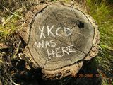
Image:XKCD_was_here_on_Dinkelman_Ridge.JPG | Fun with chalk! | Image:XKCD_was_here_on_Dinkelman_Ridge.JPG | Fun with chalk! | ||
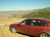
Image:Dirty_car.jpg | Suzie, the amazing car that made it up the hill. | Image:Dirty_car.jpg | Suzie, the amazing car that made it up the hill. | ||
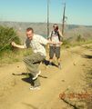
| − | Image:Orville_and_poi.jpg | Orville's mad poi skills. | + | Image:Orville_and_poi.jpg | Orville's mad poi skills. |
Image:Aaron and poi.jpg | Aaron attempting the poi while Skylar looks on. | Image:Aaron and poi.jpg | Aaron attempting the poi while Skylar looks on. | ||
Image:Quartz_Cairn.jpg | Quartz cairn. | Image:Quartz_Cairn.jpg | Quartz cairn. | ||
| Line 58: | Line 65: | ||
'''Return to:''' [[Wenatchee, Washington]] | '''Return to:''' [[Wenatchee, Washington]] | ||
| − | [[Category: | + | [[Category:Expeditions]] |
| − | [[Category: | + | [[Category:Expeditions with photos]] |
| + | [[Category:Coordinates reached]] | ||
| + | [[Category:Expedition without GPS]] | ||
| + | {{location|US|WA|CH}} | ||
Latest revision as of 05:35, 7 August 2019
| Sat 28 Jun 2008 in Wenatchee: 47.6581110, -120.3656342 geohashing.info google osm bing/os kml crox |
47.65811°, -120.365635° is located just below Dinkelman Ridge (near Entiat), about 200 feet off a forest service road.
3000 foot elevation gain in about 5 miles. No walk in the park.
Who showed up?
- PBnJ (Aaron & Jeska)
- Skylar
- Orville
- Suzie Q (the car)
Activities/Adventures
- Poi.
- Stick-ball.
- Chalk drawings.
Also...
- Aaron saw two deer.
- Skylar found rose quartz and wild dill.
- Orville got cell phone reception.
- Jeska navigated.
Afterwards, we went out for mongolian barbecue and old fashioned ice cream sodas.
Achievements
- Drag-Along Geohash: PBnJ enlisted Skylar and Orville, who had never heard of geohashing before but were game for a random adventure.
- No Batteries Geohash: Our GPS supplier fell through at the last minute, so we had to rely on GoogleMap's Terrain View and the car's trip-ometer. Would have gone the last 200 feet (off-road) with measuring string and a compass, but the straightest route was also straight up, and heavily vegetated, so we went around, and eyeballed it with just the compass.
- Circus Geohash: Orville, poi master! (Aaron also made an attempt.) We would have also tried slacklining if there had been more sturdy trees available.
- MNIMB Geohash: This goes to the car, for getting us within 200 feet of the location. The last 5 or so miles were along a very steep, narrow, dusty, and primitive forest service road. Orville got out and moved rocks every once in a while. Suzie gained a few paint scratches, and we don't want to think about the dents she probably has on the undercarriage! We're just glad we found a place to turn around.
Pictures
(Ignore the time-imprint... I thought I corrected that. I promise, we got there at about 4 pm!)
Return to: Wenatchee, Washington
