Difference between revisions of "2008-07-02 51 -2"
imported>Thomcat (Success/failure category added) |
imported>FippeBot m (Location) |
||
| Line 36: | Line 36: | ||
[[Category:Coordinates reached]] | [[Category:Coordinates reached]] | ||
[[Category:Expedition without GPS]] | [[Category:Expedition without GPS]] | ||
| + | {{location|GB|ENG|NSM}} | ||
Latest revision as of 05:40, 7 August 2019
| Wed 2 Jul 2008 in 51,-2: 51.3212162, -2.8560437 geohashing.info google osm bing/os kml crox |
Location
A field on the outskirts of Banwell, North Somerset.
Report
Bluecont, Goldcont and 414e54484f4e5942 decided to have an impromptu adventure! Seeing that today's hash was close by and readily accessible: we went.
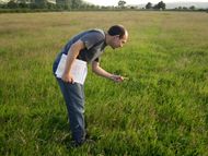
We parked on a major road nearby, and had a small walk to the spot itself. Lacking a hand-held GPS system we had to determine our location using a compass and a map! We found a field and a stile, which was very exciting! We then took photographic evidence and left.
On the way back we were (possibly) interrogated by some curious cows.
Photos
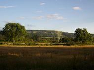
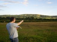
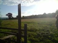
The Mendip Hills provided a stunning background.
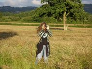
Photography of photography
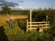
The stile was the most exciting object near the geohash. So Goldcont took a picture of it.
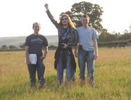
Proof that we were all here at once!
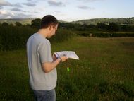
Goldcont proclaims the spot to be exactly here!
Bluecont considers matters breifly...
and slightly disagrees.
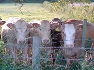
The cows came to wave at us as we passed, so they had to be documented... just in case.
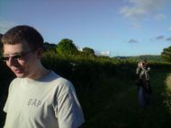
Bluecont kept walking in front of the camera!
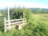
The most exciting stile itself!
The stile's more flattering side.
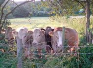
Those cows, and their barbed wire.


