Difference between revisions of "2022-02-16 52 9"
From Geohashing
(→Expedition) |
|||
| (2 intermediate revisions by 2 users not shown) | |||
| Line 1: | Line 1: | ||
{{meetup graticule|date=2022-02-16|lat=52|lon=9}} | {{meetup graticule|date=2022-02-16|lat=52|lon=9}} | ||
| − | + | ||
== Location == | == Location == | ||
Hildesheim-Himmelsthür | Hildesheim-Himmelsthür | ||
| Line 27: | Line 27: | ||
https://goo.gl/maps/rjuYgJTRjBLP2LW46 | https://goo.gl/maps/rjuYgJTRjBLP2LW46 | ||
| − | == Photos == | + | ==Photos== |
| + | [[File:20220216_172631.jpg|1000px|Surroundings]] | ||
<gallery> | <gallery> | ||
Bild1.jpg | Bild1.jpg | ||
| + | Screenshot_2022-02-16-17-27-19.png | ||
| + | Screenshot_2022-02-16-17-23-15.png | ||
| + | 16-02-2022-black_side_of_Hildesheim.jpg | ||
| + | 16-02-2022-black_side_of_Hildesheim-2D.jpg | ||
| + | 20220216_174912.jpg | der mast | ||
| + | 20220216_170540.jpg | von Oben, 20Meter runterfotografiert | ||
| + | 20220216_170547.jpg | von Oben, richtung osten | ||
| + | 20220216_170559.jpg | von Oben, richtung geohash (N/W) | ||
| + | 20220216_172951.jpg | am GeoHashPoint der Opencache | ||
| + | 20220216_173003-ok.jpg | am GeoHashPoint JoDaEmPa's Passwort | ||
</gallery> | </gallery> | ||
== Achievements == | == Achievements == | ||
| − | [[Category: | + | [[Category:Expeditions]] |
| + | [[Category:Expeditions with photos]] | ||
| + | [[Category:Coordinates reached]] | ||
[[Category:Pages in German]] | [[Category:Pages in German]] | ||
{{location|DE|NI|HI}} | {{location|DE|NI|HI}} | ||
| + | |||
| + | |||
| + | __NOTOC__ | ||
Latest revision as of 13:27, 25 February 2022
| Wed 16 Feb 2022 in 52,9: 52.1770642, 9.9049489 geohashing.info google osm bing/os kml crox |
Location
Hildesheim-Himmelsthür
Participants
Plans
Mich schrieb der gute Fippe an weil ein Hash in meiner nähe erschien und schon stand der Tagesplan fest !
Darauf machte ich eine anfrage, ob noch jemand heute zeit und lust hatte:
Tracklog
Expedition
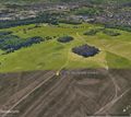
Jaaaa der Sturm hier war schon Ordentlich, aber das störte meinen 2rädligen Esel nicht ! Natürlich muste an der Final Koo, von dem heutigen Geohash ein "Opencache.de" und ein "Munzee.com" erstellt werden und freigelassen werden ! Auf dem weg dann den Munzee an einem 20meter hohen Masten plaziert der dann zum Geohash und dann zum Opencache führt ! Ein paar Fotos sind von oben vom Masten, ohne Geohash hätte ich diese aussicht bestimmt nicht gefunden !!!
In der Nähe (sehr schön): https://goo.gl/maps/rjuYgJTRjBLP2LW46
Photos
Achievements


