Difference between revisions of "2022-07-19 -36 145"
From Geohashing
Felix Dance (talk | contribs) (Created page with "Geohash 2022-07-19 -36 145 01 Hash.jpg|400px {{meetup graticule | lat=-36 | lon=145 | date=2022-07-19 }} __NOTOC__ == Location == On the side of Bonnie Doon Rd, near...") |
(→Expedition (Felix)) |
||
| (4 intermediate revisions by 2 users not shown) | |||
| Line 1: | Line 1: | ||
| − | [[File | + | [[File:Geohash 2022-07-19 -36 145 01 Hash.jpg|400px]] |
{{meetup graticule | {{meetup graticule | ||
| lat=-36 | | lat=-36 | ||
| Line 10: | Line 10: | ||
== Participants == | == Participants == | ||
| − | *[[User: | + | *[[User:Mdixon4|Matt]] |
| − | *Rhonda | + | *Rhonda |
== Expedition (Felix) == | == Expedition (Felix) == | ||
| − | [[User: | + | [[User:Mdixon4|Matt]] and Rhonda achieved this hash while driving up to the snow. They saw a powerful owl. |
== Photos == | == Photos == | ||
| Line 24: | Line 24: | ||
[[Category:Expeditions]] | [[Category:Expeditions]] | ||
[[Category:Coordinates reached]] | [[Category:Coordinates reached]] | ||
| + | {{location|AU|VIC|SB}} | ||
Latest revision as of 08:51, 20 July 2022
| Tue 19 Jul 2022 in -36,145: -36.7494815, 145.7468809 geohashing.info google osm bing/os kml crox |
Location
On the side of Bonnie Doon Rd, near Boho (technically Marraweeney).
Participants
- Matt
- Rhonda
Expedition (Felix)
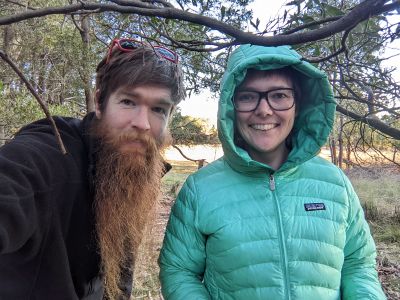
Matt and Rhonda achieved this hash while driving up to the snow. They saw a powerful owl.
