Difference between revisions of "2023-01-03 48 2"
AmeliaThe1st (talk | contribs) (→Participants) |
AmeliaThe1st (talk | contribs) (→Participants) |
||
| (One intermediate revision by one other user not shown) | |||
| Line 16: | Line 16: | ||
== Participants == | == Participants == | ||
| − | [[User:AmeliaThe1st|AmeliaThe1st]] ([[User talk:AmeliaThe1st|talk]]), and a friend from | + | [[User:AmeliaThe1st|AmeliaThe1st]] ([[User talk:AmeliaThe1st|talk]]), and a friend from her university she kidnapped (with consent). |
== Plans == | == Plans == | ||
| Line 84: | Line 84: | ||
(Don't forget to delete this final close comment marker) --> | (Don't forget to delete this final close comment marker) --> | ||
| + | {{location|FR|78}} | ||
Latest revision as of 20:27, 3 January 2023
| Tue 3 Jan 2023 in 48,2: 48.7241734, 2.1040821 geohashing.info google osm bing/os kml crox |
Location
In the Port-Royal forest, in the Yvelines.
Participants
AmeliaThe1st (talk), and a friend from her university she kidnapped (with consent).
Plans
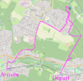
So, the plan was to leave our university after our exam, the take the RER (public transport train) line B up to Saint-Rémy-Les-Chevreuse or Courcelle-Sur-Yvette, then either take the bus up to the forest or go there on foot, eat there, then come back through either the bus or on foot, then to go back home with the RER line B.
Expedition
So, we finished our exams at 11, then bought some food to eat once there, then we took the metro, reached the RER line B, then took it all the way to Courcelle-Sur-Yvette (it took about an hour, I think). Then, we walked up to the geohash. It was kinda hard to reach it exactly, because it was off the track through spiky bushes. But, we got there eventually. Took a picture and a few more to get a proof (didn't get a good proof, but it's "readable"). We got back on the path, and sat and ate on a log nearby. Then we went back on foot down to Saint-Rémy-Les-Chevreuse, took the RER and went home


