Difference between revisions of "2023-05-01 50 16"
(Created page with "{{meetup graticule | lat=50 | lon=16 | date=2023-05-01 }} == Location == Next to a stone quarry near Kośmin village. == Participants == k4be == Plans...") |
|||
| Line 15: | Line 15: | ||
Going by train to Piława Górna (expected arrival 9:18). Walking about 3700m to the hash site, then going to walk some more, maybe reaching Gilów, and finally finding my way back to the train station. I expect the whole trip to be about 15km. | Going by train to Piława Górna (expected arrival 9:18). Walking about 3700m to the hash site, then going to walk some more, maybe reaching Gilów, and finally finding my way back to the train station. I expect the whole trip to be about 15km. | ||
| + | |||
| + | == Expedition == | ||
| + | |||
| + | Found the hash without much trouble. The only difficulty was to get through some very muddy tracks. Located several meters from a forest road, fortunately not inside the quarry perimeter. | ||
| + | |||
| + | After reaching the hash, i've headed to Gilów, and then came back to the train station by a different route. | ||
| + | |||
| + | I had wrongly read the return train schedule (noted down arrival instead of departure times), so i've rushed to the station only to find out i have to wait almost 2 hours for the next train. I've spent the time walking over the town of Piława Górna, would have planned the route differently if i knew i had so much more time. | ||
| + | |||
| + | The whole trip (not counting train rides) was about 21 km. | ||
| + | |||
| + | == Photos == | ||
| + | |||
| + | <gallery> | ||
| + | Image:2022-05-01_50_16_001.jpeg|Geohash Droid screenshot | ||
| + | Image:2022-05-01_50_16_002.jpeg|View north (at the forest road) | ||
| + | Image:2022-05-01_50_16_003.jpeg|View west | ||
| + | Image:2022-05-01_50_16_004.jpeg|View south | ||
| + | Image:2022-05-01_50_16_005.jpeg|View east | ||
| + | Image:2022-05-01_50_16_006.jpeg|The geohash poster I've taped to a tree, visible from the track | ||
| + | Image:2022-05-01_50_16_007.jpeg|The active stone quarry | ||
| + | Image:2022-05-01_50_16_008.jpeg|Nearby town of Niemcza (unfortunately, no trains there) | ||
| + | Image:2022-05-01_50_16_009.png|The whole trail, with hash point approximately marked with a blue arrow | ||
| + | </gallery> | ||
[[Category:Expeditions]] | [[Category:Expeditions]] | ||
| − | [[Category: | + | [[Category:Coordinates reached]] |
{{location|PL|D|DZ}} | {{location|PL|D|DZ}} | ||
Latest revision as of 13:07, 3 May 2023
| Mon 1 May 2023 in 50,16: 50.6960156, 16.7992520 geohashing.info google osm bing/os kml crox |
Contents
Location
Next to a stone quarry near Kośmin village.
Participants
Plans
Going by train to Piława Górna (expected arrival 9:18). Walking about 3700m to the hash site, then going to walk some more, maybe reaching Gilów, and finally finding my way back to the train station. I expect the whole trip to be about 15km.
Expedition
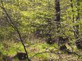
Found the hash without much trouble. The only difficulty was to get through some very muddy tracks. Located several meters from a forest road, fortunately not inside the quarry perimeter.
After reaching the hash, i've headed to Gilów, and then came back to the train station by a different route.
I had wrongly read the return train schedule (noted down arrival instead of departure times), so i've rushed to the station only to find out i have to wait almost 2 hours for the next train. I've spent the time walking over the town of Piława Górna, would have planned the route differently if i knew i had so much more time.
The whole trip (not counting train rides) was about 21 km.
Photos

Geohash Droid screenshot
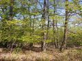
View north (at the forest road)
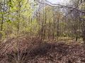
View west
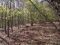
View south
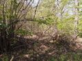
View east
The geohash poster I've taped to a tree, visible from the track
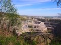
The active stone quarry
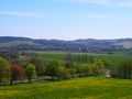
Nearby town of Niemcza (unfortunately, no trains there)
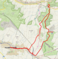
The whole trail, with hash point approximately marked with a blue arrow


