Difference between revisions of "2023-09-24 -37 145"
From Geohashing
(Created page with "{{meetup graticule|date=2023-09-24|lat=-37|lon=145}} ==Location== ==Participants== *Talex ==Expedition== Was already out for a ride, did a few extra kms to ge...") |
m (uncommenting) |
||
| (7 intermediate revisions by 2 users not shown) | |||
| Line 1: | Line 1: | ||
{{meetup graticule|date=2023-09-24|lat=-37|lon=145}} | {{meetup graticule|date=2023-09-24|lat=-37|lon=145}} | ||
==Location== | ==Location== | ||
| + | In a roundabout in Donvale | ||
==Participants== | ==Participants== | ||
| Line 6: | Line 7: | ||
==Expedition== | ==Expedition== | ||
| − | + | I'd planned to get out for a quick MTB ride on Sunday morning. Sunday's hash was not too far further on and I thought I'd have a crack if I had enough spare time. | |
| + | |||
| + | After I'd done my planned loop, I rode on to the hash. The ride out was mildly tedious, the shared path was busy (it was a stunning morning) and I didn't notice that it was following the creek upstream. After reaching Tindals Rd, I turned off the path and climbed up. I parked my bike next to the road and jumped out to the hash when there was a suitable gap in traffic. Returning home I took the more scenic route, along some lovely river side single track. | ||
==Photos== | ==Photos== | ||
<gallery heights="300px" mode="packed"> | <gallery heights="300px" mode="packed"> | ||
| + | |||
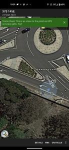
| + | Image:2023-09-24_-37_145_talex_1695551788653.jpg|GPS proof | ||
| + | |||
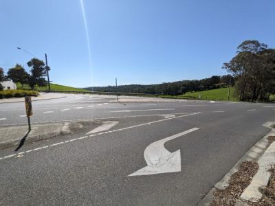
| + | Image:2023-09-24_-37_145_talex_1695551847787.jpg|The hash point | ||
| + | |||
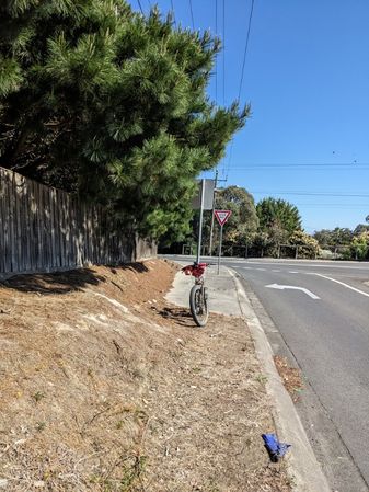
| + | Image:2023-09-24_-37_145_talex_1695551862730.jpg|Hash transport | ||
| + | |||
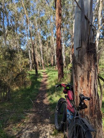
| + | Image:2023-09-24_-37_145_talex_1695551893939.jpg|Much nicer here... | ||
</gallery> | </gallery> | ||
==Achievements== | ==Achievements== | ||
{{#vardefine:ribbonwidth|100%}} | {{#vardefine:ribbonwidth|100%}} | ||
| − | |||
{{Bicycle geohash|latitude=-37|longitude=145|date=2023-09-24|name=Talex|distance=40km}} | {{Bicycle geohash|latitude=-37|longitude=145|date=2023-09-24|name=Talex|distance=40km}} | ||
| − | |||
__NOTOC__ | __NOTOC__ | ||
| − | |||
[[Category:Expeditions]] | [[Category:Expeditions]] | ||
[[Category:Coordinates reached]] | [[Category:Coordinates reached]] | ||
[[Category:Expeditions with photos]] | [[Category:Expeditions with photos]] | ||
| − | + | {{location|AU|VIC|MN}} | |
Latest revision as of 18:15, 26 September 2023
| Sun 24 Sep 2023 in -37,145: -37.7718226, 145.1994730 geohashing.info google osm bing/os kml crox |
Location
In a roundabout in Donvale
Participants
Expedition
I'd planned to get out for a quick MTB ride on Sunday morning. Sunday's hash was not too far further on and I thought I'd have a crack if I had enough spare time.
After I'd done my planned loop, I rode on to the hash. The ride out was mildly tedious, the shared path was busy (it was a stunning morning) and I didn't notice that it was following the creek upstream. After reaching Tindals Rd, I turned off the path and climbed up. I parked my bike next to the road and jumped out to the hash when there was a suitable gap in traffic. Returning home I took the more scenic route, along some lovely river side single track.
Photos
Achievements
Talex earned the Bicycle geohash achievement
|


