Difference between revisions of "2024-03-12 31 34"
(Yerushalmi via Discord / Yosef via WhatsApp) |
m |
||
| (3 intermediate revisions by 3 users not shown) | |||
| Line 6: | Line 6: | ||
*[[User:Yerushalmi|Yerushalmi]] | *[[User:Yerushalmi|Yerushalmi]] | ||
*[[User:Yosef|Yosef]] | *[[User:Yosef|Yosef]] | ||
| + | |||
| + | ==Plans== | ||
| + | ===Yerushalmi=== | ||
| + | I started today at [[2024-03-12_32_34|32 34 point]], and plannd to go to this one afterwards if time permitted. According to Moovit, the best way to do this is take the train straight down to Ramla and a bus from there. | ||
==Expedition== | ==Expedition== | ||
===Yerushalmi=== | ===Yerushalmi=== | ||
| − | + | For various stupid reasons that were my fault for not checking something obvious, I couldn't take the train straight to Ramla. But this was NBD. I took the train to Modi'in instead, and from there a bus. From there it was an easy ten-minute walk to the point. | |
| − | + | ||
| + | The walk was confusing; there were a few places that were simultaneously marked trails and had "no trespassing" signs. I think the signs were simply not turned in the right direction or whatever, and they meant you shouldn't go into the planted fields. | ||
| + | |||
| + | The sun was setting and I got a nice recording of the monastery bells: | ||
| + | |||
| + | [[File:20240312_175535.mp4|500px]] | ||
| + | |||
| + | From the point I walked back to the bus stop, and bus home to Jerusalem. | ||
| + | |||
| + | |||
| + | ===Yosef=== | ||
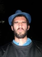
| + | I didn't get myself going in the morning but I was in the area that night. I drove over to picnic grove of the Monastery and then wandered the field at night. Yerushalmi is pummelling me this year. | ||
==Photos== | ==Photos== | ||
| Line 20: | Line 35: | ||
2024-03-12 31 34 Geohash.jpg | 2024-03-12 31 34 Geohash.jpg | ||
</gallery> | </gallery> | ||
| + | |||
| + | ===Yerushalmi=== | ||
| + | <gallery> | ||
| + | File:20240312_174855.jpg | Blurry photo of the sunset | ||
| + | File:20240312_175001.jpg | Marked trail: the white-blue-orange stripe on the pole indicates this path is the Israel National Trail that goes the length of the country from north to south. | ||
| + | File:20240312_175015.jpg | Trail markings saying to turn left, and a Private Property sign *on top of the trail markings*. The sign presumably refers to the field, not the trail. | ||
| + | File:20240312_175336.jpg | Entering the grove of regular trees where the point is | ||
| + | File:Screenshot_20240312_175700_Geohash Droid.jpg | Proof | ||
| + | File:20240312_175708.jpg | Panorama at the point | ||
| + | </gallery> | ||
| + | |||
==Ribbons== | ==Ribbons== | ||
| Line 28: | Line 54: | ||
[[Category:Expeditions]] | [[Category:Expeditions]] | ||
[[Category:Expeditions with photos]] | [[Category:Expeditions with photos]] | ||
| + | [[Category:Expeditions with videos]] | ||
[[Category:Coordinates reached]] | [[Category:Coordinates reached]] | ||
| + | {{location|IL|JM}} | ||
Latest revision as of 11:57, 16 March 2024
| Tue 12 Mar 2024 in 31,34: 31.8300870, 34.9787946 geohashing.info google osm bing/os kml crox |
Location
This Geohash is located in a grove of trees on the grounds of the Latrun Monastery.
Participants
Plans
Yerushalmi
I started today at 32 34 point, and plannd to go to this one afterwards if time permitted. According to Moovit, the best way to do this is take the train straight down to Ramla and a bus from there.
Expedition
Yerushalmi
For various stupid reasons that were my fault for not checking something obvious, I couldn't take the train straight to Ramla. But this was NBD. I took the train to Modi'in instead, and from there a bus. From there it was an easy ten-minute walk to the point.
The walk was confusing; there were a few places that were simultaneously marked trails and had "no trespassing" signs. I think the signs were simply not turned in the right direction or whatever, and they meant you shouldn't go into the planted fields.
The sun was setting and I got a nice recording of the monastery bells:
From the point I walked back to the bus stop, and bus home to Jerusalem.
Yosef
I didn't get myself going in the morning but I was in the area that night. I drove over to picnic grove of the Monastery and then wandered the field at night. Yerushalmi is pummelling me this year.
Photos
Yosef
Yerushalmi
Ribbons
Yerushalmi earned the Multihash Achievement
|


