Difference between revisions of "2024-07-11 33 35"
(via WhatsApp) |
(→Expedition) |
||
| (One intermediate revision by one other user not shown) | |||
| Line 8: | Line 8: | ||
==Expedition== | ==Expedition== | ||
Yosef was not in Beirut, his receiver just thought that because of the ongoing GNSS jamming. Instead, he figured out a clever way to verify his position using the sun. | Yosef was not in Beirut, his receiver just thought that because of the ongoing GNSS jamming. Instead, he figured out a clever way to verify his position using the sun. | ||
| + | |||
| + | [[User:Yosef|Yosef]] ([[User talk:Yosef|talk]]) 21:25, 15 July 2024 (UTC): Thanks [[user:Fippe]]. | ||
| + | |||
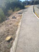
| + | I decided that I had to do another expedition so I drove all the way up north to a grave of the Druze Sheikh Sultan Ibrahim. From there I walked a few kilometers up the hill to the entrance of the fortress. Everything was closed because of the war and I lost a lot of time finding out that all of the nice trails were closed and that I needed to just walk along the highway. | ||
| + | |||
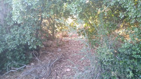
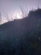
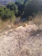
| + | I called Fippe when I got to the area of the hash point and told him that the GPS was jammed and showing us in the Beirut Airport. That was probably due to the current conflict with Hezbollah. At any rate, you'll notice that the picture with the sun is just over a fortress and the sun picture for that time also has the sun over the fortress. It's close enough. The trails have not been maintained because of the war and most of the Jews and Druze have left the area or are trying to hide from the rockets. I got pricked by a lot of thorns. | ||
==Photos== | ==Photos== | ||
| Line 26: | Line 32: | ||
[[Category:Expeditions with photos]] | [[Category:Expeditions with photos]] | ||
[[Category:Expedition without GPS]] | [[Category:Expedition without GPS]] | ||
| + | {{location|IL|Z|GO}} | ||
Latest revision as of 21:25, 15 July 2024
| Thu 11 Jul 2024 in 33,35: 33.2510550, 35.7162840 geohashing.info google osm bing/os kml crox |
Location
This Geohash is located next to a path south of the Nimrod Fortress.
Participants
Expedition
Yosef was not in Beirut, his receiver just thought that because of the ongoing GNSS jamming. Instead, he figured out a clever way to verify his position using the sun.
Yosef (talk) 21:25, 15 July 2024 (UTC): Thanks user:Fippe.
I decided that I had to do another expedition so I drove all the way up north to a grave of the Druze Sheikh Sultan Ibrahim. From there I walked a few kilometers up the hill to the entrance of the fortress. Everything was closed because of the war and I lost a lot of time finding out that all of the nice trails were closed and that I needed to just walk along the highway.
I called Fippe when I got to the area of the hash point and told him that the GPS was jammed and showing us in the Beirut Airport. That was probably due to the current conflict with Hezbollah. At any rate, you'll notice that the picture with the sun is just over a fortress and the sun picture for that time also has the sun over the fortress. It's close enough. The trails have not been maintained because of the war and most of the Jews and Druze have left the area or are trying to hide from the rockets. I got pricked by a lot of thorns.


