Difference between revisions of "2024-07-29 42 74"
Felix Dance (talk | contribs) ([retro picture]Power) |
(→Photos) |
||
| (18 intermediate revisions by 3 users not shown) | |||
| Line 1: | Line 1: | ||
| − | + | [[Image:{{{image|2024-07-29_42_74_Felix Dance _1722374896723.jpg}}}|thumb|left]] | |
| − | + | {{meetup graticule|date=2024-07-29|lat=42|lon=74}} | |
| + | == Location == | ||
| + | Outside the city limits of Bishkek. | ||
| + | |||
| + | == Participants == | ||
| + | *[[User:Stevage|Stevage]] | ||
| + | *[[User:Kt|KT]] | ||
| + | |||
| + | == Expedition == | ||
| + | ===The pre-expedition === | ||
| + | KT has been riding horses through the the Kyrgyzstan highlands for the last 18 days. I’m at the start of a long central Azian hiking holiday. We overlap for about 5 days, just enough to squeeze in a few days of hiking in the Ala Archa region and…a geohash? | ||
| + | |||
| + | But the schedule is tight. We’re meeting in Bishkek on the afternoon of the 28th, and going hiking on the 29th. There’s not a lot of flexibility! | ||
| + | |||
| + | And then, I check the geohashes and…it’s a miracle! The point on the 29th is only a 30 minute drive southeast from Bishkek. It’s very close to a road, and looks like disused land. Our hike is south. We can make this work! | ||
| + | |||
| + | Our plan: spend the morning efficiently gathering maps and supplies, pack, and take a taxi via the geohash to the Ala Archa area where we will first dump some of our gear at a hotel. | ||
| + | |||
| + | Attempting to acquire a map of the hike is a hilarious shmozzles. I’ve already had one attempt locating a map shop “GeoID” but apparently gave up too easily. According to the guide I was supposed to continue inside the unmarked door, past the security guard, up to the fourth floor, down to the end of the corridor, and there would be map heaven. Full of confidence, we attempt this. It is definitely, definitively, not there. | ||
| + | |||
| + | Second attempt, we go to one of two addresses we have for the “Trekking Union of Kyrgyzstan”. There is a hairdresser’s. No map shop. | ||
| − | + | Attempt three, we go to the other address we have. It’s not there. There’s a mosque with people coming in and out. In desperation I take a few steps closer and notice around the side of the mosque, a small sign: “Trekking Union of Kyrgzstan”. Arrows lead to more signs which have more arrows, some of which point in the correct direction. Eventually we arrive, and ask about the promised map. The map they have for sale is terrible. It’s worse than either of the two digital maps we already have. I buy a different map for a different region I’m going to later, and we give up and head back to the hotel. | |
| − | |||
| − | + | === The expedition === | |
| − | + | We summon a YandexGo (like Uber) and ponder how to explain why we are going to the point. To our good fortune, the driver is a young Pakistani man with excellent English and a good sense of curiosity and adventure. We try to explain geohashing without getting too technical, and he seems pleased to be part of it. | |
| − | + | ||
| − | + | Passing the time on the journey he tells us colourful tales of business misadventure (business partners in jail now), misdeeds (friends in jail now), and his home life (living with his brother and his two wives, who hate each other and each want the other divorced). He’s studying to be a doctor, | |
| + | |||
| + | Traffic is heavy but he seems to know some clever back ways. Bishkek seems to extend out much further than I expected. We are quite close to the point by the time it starts to feel very rural. | ||
| + | |||
| + | I ask him if he has been here before. “No, never”. Then he reconsiders. “Yes. My girlfriend lives here.” | ||
| + | |||
| + | We start to drive over a bridge and I suddenly realise we’ll end up on the wrong side of the canal this way. I speak up and our driver is very apologetic. He got caught up in his stories, and immediately reverses, much to the consternation of a car behind us. | ||
| + | |||
| + | Now we’re very close. There are distant fields of corn, and much closer fields of dead thistles. This could be a pretty savage bush bash! | ||
| + | |||
| + | Our driver has no concerns about the rough dirt road, and gets as close as possible, barely 20m from the point. It’s so easy! In the bright sunshine we stride out across short grass, giving the thistles a wide berth. | ||
| + | |||
| + | Success! Hugs and high fives. First geohash in Kyrgyzstan! We take a celebratory photo with our driver (alas, we didn’t think of dragging him to the point itself). | ||
| − | + | Then we embark on what turns out to be the much more diffficult quest of finding our hotel at Ala-Archa. But that’s a story for another day. | |
| − | |||
| − | |||
| − | |||
| − | |||
| − | |||
| − | |||
| − | |||
| − | |||
== Photos == | == Photos == | ||
| − | + | ||
| − | + | <gallery heights="300px" mode="packed"> | |
| − | |||
| − | <gallery | ||
Image:2024-07-29_42_74_Felix Dance _1722374878918.jpg|At the hash with KT | Image:2024-07-29_42_74_Felix Dance _1722374878918.jpg|At the hash with KT | ||
| Line 34: | Line 55: | ||
Image:2024-07-29_42_74_Felix Dance _1722374896723.jpg|With taxi driver | Image:2024-07-29_42_74_Felix Dance _1722374896723.jpg|With taxi driver | ||
| − | Image:2024-07-29_42_74_Felix Dance _1722374911749.jpg| | + | Image:2024-07-29_42_74_Felix Dance _1722374911749.jpg|View from the hash |
| + | |||
| + | Image:2024-07-29_42_74_Felix Dance _1722374924530.jpg|View from the hash | ||
| + | |||
| + | Image:2024-07-29_42_74_Felix Dance _1722374930774.jpg|Dried thistles near the hash. Thank god we didn’t have to go through them. That’s our taxi in the distance. | ||
| + | |||
| + | Image:2024-07-29_42_74_Felix Dance _1722374951020.jpg|GPS proof | ||
| + | |||
| + | Image:2024-07-29_42_74_Felix Dance _1722374964100.jpg|KT in the taxi | ||
| + | |||
| + | Image:2024-07-29_42_74_Felix Dance _1722374988215.jpg|KT and the thistles of doom. | ||
| + | |||
| + | Image:2024-07-29_42_74_Felix Dance _1722374999380.jpg|Trees | ||
| + | |||
| + | Image:2024-07-29_42_74_Felix Dance _1722375038407.jpg|Structure of some sort - maybe wheat processing? It had silos. We’re not sure. | ||
</gallery> | </gallery> | ||
== Achievements == | == Achievements == | ||
{{#vardefine:ribbonwidth|100%}} | {{#vardefine:ribbonwidth|100%}} | ||
| − | |||
| − | + | {{Graticule unlocked | |
| − | |||
| − | |||
| − | |||
| − | + | | latitude = 42 | |
| − | + | | longitude = 74 | |
| − | + | | date = 2024-07-29 | |
| − | + | | name = Stevage and KT | |
| + | }} | ||
| − | + | __NOTOC__ | |
[[Category:Expeditions]] | [[Category:Expeditions]] | ||
| − | |||
[[Category:Expeditions with photos]] | [[Category:Expeditions with photos]] | ||
| − | |||
| − | |||
| − | |||
| − | |||
[[Category:Coordinates reached]] | [[Category:Coordinates reached]] | ||
| − | + | {{location|KG|C}} | |
| − | |||
| − | |||
| − | |||
| − | |||
| − | |||
| − | |||
| − | |||
| − | |||
| − | |||
| − | |||
| − | |||
| − | |||
| − | |||
Latest revision as of 03:46, 3 August 2024

| Mon 29 Jul 2024 in 42,74: 42.8508491, 74.7588332 geohashing.info google osm bing/os kml crox |
Location
Outside the city limits of Bishkek.
Participants
Expedition
The pre-expedition
KT has been riding horses through the the Kyrgyzstan highlands for the last 18 days. I’m at the start of a long central Azian hiking holiday. We overlap for about 5 days, just enough to squeeze in a few days of hiking in the Ala Archa region and…a geohash?
But the schedule is tight. We’re meeting in Bishkek on the afternoon of the 28th, and going hiking on the 29th. There’s not a lot of flexibility!
And then, I check the geohashes and…it’s a miracle! The point on the 29th is only a 30 minute drive southeast from Bishkek. It’s very close to a road, and looks like disused land. Our hike is south. We can make this work!
Our plan: spend the morning efficiently gathering maps and supplies, pack, and take a taxi via the geohash to the Ala Archa area where we will first dump some of our gear at a hotel.
Attempting to acquire a map of the hike is a hilarious shmozzles. I’ve already had one attempt locating a map shop “GeoID” but apparently gave up too easily. According to the guide I was supposed to continue inside the unmarked door, past the security guard, up to the fourth floor, down to the end of the corridor, and there would be map heaven. Full of confidence, we attempt this. It is definitely, definitively, not there.
Second attempt, we go to one of two addresses we have for the “Trekking Union of Kyrgyzstan”. There is a hairdresser’s. No map shop.
Attempt three, we go to the other address we have. It’s not there. There’s a mosque with people coming in and out. In desperation I take a few steps closer and notice around the side of the mosque, a small sign: “Trekking Union of Kyrgzstan”. Arrows lead to more signs which have more arrows, some of which point in the correct direction. Eventually we arrive, and ask about the promised map. The map they have for sale is terrible. It’s worse than either of the two digital maps we already have. I buy a different map for a different region I’m going to later, and we give up and head back to the hotel.
The expedition
We summon a YandexGo (like Uber) and ponder how to explain why we are going to the point. To our good fortune, the driver is a young Pakistani man with excellent English and a good sense of curiosity and adventure. We try to explain geohashing without getting too technical, and he seems pleased to be part of it.
Passing the time on the journey he tells us colourful tales of business misadventure (business partners in jail now), misdeeds (friends in jail now), and his home life (living with his brother and his two wives, who hate each other and each want the other divorced). He’s studying to be a doctor,
Traffic is heavy but he seems to know some clever back ways. Bishkek seems to extend out much further than I expected. We are quite close to the point by the time it starts to feel very rural.
I ask him if he has been here before. “No, never”. Then he reconsiders. “Yes. My girlfriend lives here.”
We start to drive over a bridge and I suddenly realise we’ll end up on the wrong side of the canal this way. I speak up and our driver is very apologetic. He got caught up in his stories, and immediately reverses, much to the consternation of a car behind us.
Now we’re very close. There are distant fields of corn, and much closer fields of dead thistles. This could be a pretty savage bush bash!
Our driver has no concerns about the rough dirt road, and gets as close as possible, barely 20m from the point. It’s so easy! In the bright sunshine we stride out across short grass, giving the thistles a wide berth.
Success! Hugs and high fives. First geohash in Kyrgyzstan! We take a celebratory photo with our driver (alas, we didn’t think of dragging him to the point itself).
Then we embark on what turns out to be the much more diffficult quest of finding our hotel at Ala-Archa. But that’s a story for another day.
Photos

At the hash with KT

With taxi driver

View from the hash
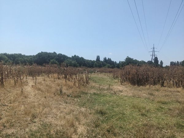
View from the hash

Dried thistles near the hash. Thank god we didn’t have to go through them. That’s our taxi in the distance.

GPS proof
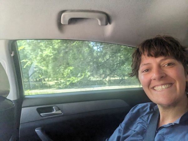
KT in the taxi

KT and the thistles of doom.
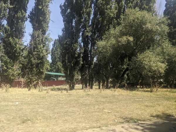
Trees
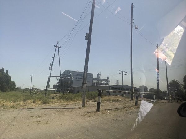
Structure of some sort - maybe wheat processing? It had silos. We’re not sure.


Achievements
Stevage and KT earned the Graticule Unlocked Achievement
|