Difference between revisions of "2024-08-03 41 -88"
(→Expedition) |
Tarasaurus (talk | contribs) (categories) |
||
| (4 intermediate revisions by 3 users not shown) | |||
| Line 12: | Line 12: | ||
== Participants == | == Participants == | ||
| − | + | [[User:Rookiek13|Rookiek13]] | |
== Plans == | == Plans == | ||
| Line 33: | Line 33: | ||
--> | --> | ||
<gallery perrow="5"> | <gallery perrow="5"> | ||
| + | Image:452303317 761910932576867 2427690078103987526 n.jpg |The parking space the hash was on | ||
| + | |||
| + | Image:452327234 887173476575024 9051634481475878786 n.jpg |The elementary school | ||
| + | |||
| + | Image:452521681 870682774982483 1239847420420717534 n.jpg |Proof! | ||
| + | |||
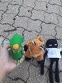
| + | Image:454017119 902055138402077 8881777640000318417 n.jpg|Hashscots Geo, Endy, and Mei riding safely to the hashpoint | ||
| + | |||
| + | Image:452534121 467940256038011 3154239735725162192 n.jpg|We pose at the hashpoint | ||
| + | |||
| + | Image:452677505 340836859101424 8060797703476100540 n.jpg|Endy peruses the library box | ||
| + | |||
</gallery> | </gallery> | ||
== Achievements == | == Achievements == | ||
{{#vardefine:ribbonwidth|100%}} | {{#vardefine:ribbonwidth|100%}} | ||
| − | |||
| − | |||
| − | |||
| − | |||
| − | |||
| − | |||
| − | |||
| − | |||
[[Category:Expeditions]] | [[Category:Expeditions]] | ||
| − | |||
[[Category:Expeditions with photos]] | [[Category:Expeditions with photos]] | ||
| − | |||
| − | |||
| − | |||
| − | |||
[[Category:Coordinates reached]] | [[Category:Coordinates reached]] | ||
| − | |||
| − | |||
| − | |||
| − | |||
| − | |||
| − | |||
| − | |||
| − | |||
| − | |||
| − | |||
| − | + | {{land geohash | |
| + | | latitude = 41 | ||
| + | | longitude = -88 | ||
| + | | date = 2024-06-11 | ||
| + | | name =Rookiek13 | ||
| + | }} | ||
| + | {{location|US|IL|DU}} | ||
Latest revision as of 08:20, 8 August 2024
| Sat 3 Aug 2024 in 41,-88: 41.7371133, -88.0500816 geohashing.info google osm bing/os kml crox |
Location
The parking lot of an elementary school
Participants
Plans
Drive over while out doing errands
Expedition
I checked the hash for the day and it was close by! It wasn't that far from where I was going to be running errands, so I grabbed my stuff and headed out. It was only a short drive (and a lot closer than I thought) and I was there. I parked in a rather nice brick parking lot and headed over. The gps showed it to be off to the side of the parking lot, just before a fenced maintenance area. With hashcrew in hand, we quickly took photos as proof of our victory and checked out the Little Free Library on premises. Then it was off to do my Adulting for the day.
Tracklog
Photos
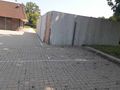
The parking space the hash was on
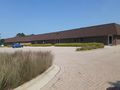
The elementary school
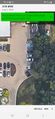
Proof!
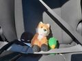
Hashscots Geo, Endy, and Mei riding safely to the hashpoint
We pose at the hashpoint
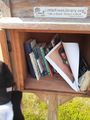
Endy peruses the library box


Achievements
Rookiek13 earned the Land geohash achievement
|