Difference between revisions of "2024-08-25 50 6"
(new report, photos to follow) |
(→Expedition: inverse retro report) |
||
| (One intermediate revision by one other user not shown) | |||
| Line 15: | Line 15: | ||
In Vaals, I first crossed the border into the Netherlands, and after a few minutes, I crossed the forest border into Belgium. The coordinates were not far now, I parked the bike and approached the mast meters on foot. I located the coordinates among some holly trees and bare conifers, recorded proof, and walked back to the bicycle. | In Vaals, I first crossed the border into the Netherlands, and after a few minutes, I crossed the forest border into Belgium. The coordinates were not far now, I parked the bike and approached the mast meters on foot. I located the coordinates among some holly trees and bare conifers, recorded proof, and walked back to the bicycle. | ||
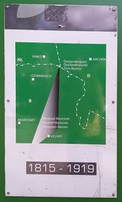
| − | Next, I checked out the nearby tripoint, where the territories of Belgium, the Netherlands and Germany meet. It used to be a quadripoint in the days of [[wikipedia:Neutral Moresnet|Neutral Moresnet]], a condominium of Belgium and Prussia that the Esperanto community declared its world capital. | + | Next, I checked out the nearby tripoint, where the territories of Belgium, the Netherlands and Germany meet. It used to be a quadripoint in the days of [[wikipedia:Neutral Moresnet|Neutral Moresnet]], a condominium of Belgium and Prussia that the Esperanto community declared its world capital. At 322 meters above the sea, the Vaalserberg also is the highest point of the European Netherlands. |
| − | Afterwards, I cycled to Aachen Central, | + | Afterwards, I cycled to Aachen Central, took the train via Herzogenrath and Düsseldorf to Osnabrück Central and walked back home. |
| + | |||
| + | ===π π π=== | ||
| + | I was in Aachen when the coordinates were released on Friday afternoon. I had considered visiting the tripoint anyway, and a hash so very close by made it even more tempting (even though it would only be an inverse retro, since I would probably not be close by on Sunday). Around 4 pm, I decided to go for it and hopped on the next bus to Vaals, which to my surprised arrived out of schedule after the last one had departed right before my eyes. I got off at Vaalserquartier just before the border (interestingly again, the bus drived announced he'd stop before the border just before I got off). I walked half an hour through fields and forest until I reached the tripoint with its massive viewing tower. I's been there before like 18 years ago, but hardly remembered it. | ||
| + | |||
| + | After taking some photos, eating some bread, and talking to a nice lady who wanted to gift me different versions of the bible, I walked the last 600 m to the hash, the end stretch leading through thickening underbrush. After I made it, I rushed back to Vaalserquartier to make it to my bus in time, which I just managed. | ||
| + | |||
| + | ==Photos== | ||
| + | ===Fippe=== | ||
| + | <gallery mode="packed" heights="196px"> | ||
| + | 2024-08-25 50 6 01 Bike.jpg | The rental near the coordinates | ||
| + | 2024-08-25 50 6 04 Surroundings.jpg | Surroundings | ||
| + | 2024-08-25 50 6 03 Geohash.jpg | The Geohash | ||
| + | 2024-08-25 50 6 02 Proof.jpg | Proof | ||
| + | 2024-08-25 50 6 05 Site.jpg | The site of the Geohash | ||
| + | 2024-08-25 50 6 06 Quadripoint.jpg | A map of the former quadripoint | ||
| + | 2024-08-25 50 6 07 Tripoint.jpg | The tripoint | ||
| + | </gallery> | ||
| + | |||
| + | ==Tracklog== | ||
| + | ===Fippe=== | ||
| + | {{tracklog|2024-08-25 50 6 08 Tracklog.gpx}} | ||
| + | |||
| + | ==Ribbons== | ||
| + | {{#vardefine:ribbonwidth|100%}} | ||
| + | {{land geohash|date=2024-08-25|latitude=50|longitude=6|name=[[User:Fippe|Fippe]]|image=2024-08-25 50 6 03 Geohash.jpg}} | ||
| + | {{border geohash|country1=German-Dutch|country2=Belgian|date=2024-08-25|latitude=50|longitude=6|name=[[User:Fippe|Fippe]]|image=2024-08-25 50 6 07 Tripoint.jpg}} | ||
__NOTOC__ | __NOTOC__ | ||
| Line 26: | Line 52: | ||
[[Category:Expeditions with photos]] | [[Category:Expeditions with photos]] | ||
{{location|BE|WLG}} | {{location|BE|WLG}} | ||
| + | {{user categories|user=Fippe|hours=12|foot=6|train=529|bike=13}} | ||
Latest revision as of 14:50, 7 September 2024
| Sun 25 Aug 2024 in 50,6: 50.7538654, 6.0136727 geohashing.info google osm bing/os kml crox |
Location
This Geohash is located in a forest in Gemmenich.
Inverse Retro
Participants
Expedition
Fippe
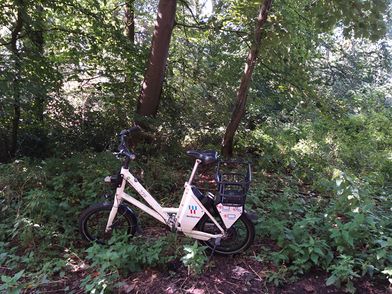
In the morning, I walked to Osnabrück Central and took the train via Düsseldorf to Aachen-West. There, I rented an e-bike and cycled the rest of the distance.
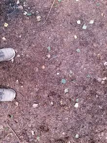
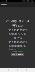
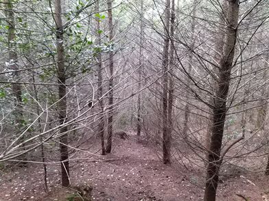
In Vaals, I first crossed the border into the Netherlands, and after a few minutes, I crossed the forest border into Belgium. The coordinates were not far now, I parked the bike and approached the mast meters on foot. I located the coordinates among some holly trees and bare conifers, recorded proof, and walked back to the bicycle.
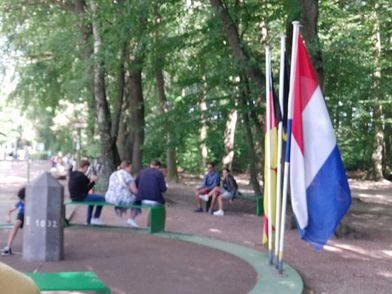
Next, I checked out the nearby tripoint, where the territories of Belgium, the Netherlands and Germany meet. It used to be a quadripoint in the days of Neutral Moresnet, a condominium of Belgium and Prussia that the Esperanto community declared its world capital. At 322 meters above the sea, the Vaalserberg also is the highest point of the European Netherlands.
Afterwards, I cycled to Aachen Central, took the train via Herzogenrath and Düsseldorf to Osnabrück Central and walked back home.
π π π
I was in Aachen when the coordinates were released on Friday afternoon. I had considered visiting the tripoint anyway, and a hash so very close by made it even more tempting (even though it would only be an inverse retro, since I would probably not be close by on Sunday). Around 4 pm, I decided to go for it and hopped on the next bus to Vaals, which to my surprised arrived out of schedule after the last one had departed right before my eyes. I got off at Vaalserquartier just before the border (interestingly again, the bus drived announced he'd stop before the border just before I got off). I walked half an hour through fields and forest until I reached the tripoint with its massive viewing tower. I's been there before like 18 years ago, but hardly remembered it.
After taking some photos, eating some bread, and talking to a nice lady who wanted to gift me different versions of the bible, I walked the last 600 m to the hash, the end stretch leading through thickening underbrush. After I made it, I rushed back to Vaalserquartier to make it to my bus in time, which I just managed.
Photos
Fippe
Tracklog
Fippe
Ribbons
Fippe earned the Land geohash achievement
|
Fippe earned the Border geohash achievement
|
- Meetup on 2024-08-25
- Meetup in 50 6
- Expeditions with tracklogs
- Land geohash achievement
- Border geohash achievement
- Retro meetup
- Retro coordinates reached
- Expeditions
- Coordinates reached
- Expeditions with photos
- Meetup in Province de Liège
- Expeditions by Fippe
- Fippe's expeditions by bike
- Fippe's expeditions on foot
- Fippe's expeditions by train
