Difference between revisions of "2024-09-24 47 8"
Globescorer (talk | contribs) (Created page with "{{meetup graticule|date=2024-09-24|lat=47|lon=8}} ==Location== This Geohash is located in a forest between Gündlikon and Buch. ==Participants== *User:globescorer|globescor...") |
(sorry for my late report) |
||
| (17 intermediate revisions by 3 users not shown) | |||
| Line 11: | Line 11: | ||
== Expedition == | == Expedition == | ||
| + | This geohash seemed doable. But is there enough time for that? I have to finish the building application for my parents and other errands... | ||
| + | |||
| + | When everything was settled, I looked at the times on Google Maps and thought: it could be tight, but if the terrain is good on site it will be enough. | ||
| + | |||
| + | So overall it was a quick thing, but the location at the coordinates was wonderful. 20 minutes there and 20 minutes back after the visit by car. | ||
| + | |||
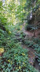
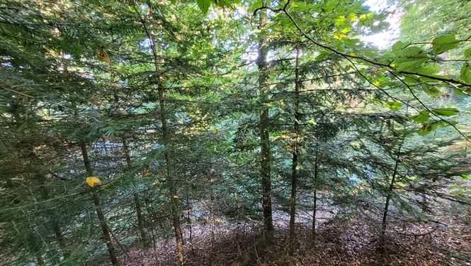
| + | In between, I entered another world through the thicket at the edge of the forest. Lush green everywhere and slightly sloping terrain... ...but it got steeper and steeper and I saw a stream below that apparently had to be crossed! I passed a fox hole and luckily it had some logged wood that I could use as a bridge. | ||
| + | |||
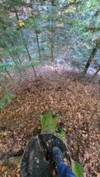
| + | Over there it was a steep climb again to the coordinates. Everything looked simpler in the aerial photo... But the location was very nice! There should actually be a geocache here. I took a quick breather, then took my photos and then I had to go back. Time was running out. -> Speedrun | ||
| + | |||
| + | '''It was worth it! Success!''' | ||
== Photos == | == Photos == | ||
<gallery mode="packed" heights="250px"> | <gallery mode="packed" heights="250px"> | ||
| − | File:2024-09- | + | File:2024-09-24 47 8 way to go 1.jpg|Way to go 1 / entering the forest |
| − | File:2024-09- | + | </gallery> |
| − | File:2024-09- | + | <p></p> |
| − | File:2024-09- | + | <gallery mode="packed" heights="250px"> |
| − | File:2024-09- | + | File:2024-09-24 47 8 fox hole.jpg|fox hole |
| − | File:2024-09- | + | File:2024-09-24 47 8 way to go 2.jpg|Way to go 2 / down to the stream |
| − | File:2024-09- | + | File:2024-09-24 47 8 bridge 2.jpg|there's my bridge |
| − | File:2024-09- | + | File:2024-09-24 47 8 The Geohash.jpg|the geohash on the other side |
| − | File:2024-09- | + | File:2024-09-24 47 8 proof 1.jpg|The proof 1 |
| − | File:2024-09- | + | File:2024-09-24 47 8 proof 2.jpg|The proof 2 |
| − | + | File:2024-09-24 47 8 north.jpg|north | |
| − | + | File:2024-09-24 47 8 west.jpg|west | |
| + | File:2024-09-24 47 8 south.jpg|south | ||
| + | File:2024-09-24 47 8 east.jpg|east | ||
</gallery> | </gallery> | ||
| Line 32: | Line 45: | ||
== Achievements == | == Achievements == | ||
{{#vardefine:ribbonwidth|100%}} | {{#vardefine:ribbonwidth|100%}} | ||
| − | {{land geohash|date=2024-09- | + | {{land geohash|date=2024-09-24|latitude=47|longitude=8|name=[[User:globescorer|globescorer]]|image=2024-09-24 47 8 The Geohash.jpg}} |
| + | {{Speedrun achievement | ||
| + | | latitude = 47 | ||
| + | | longitude = 8 | ||
| + | | date = 2024-09-24 | ||
| + | | minutes = 55 | ||
| + | | name = [[User:globescorer|globescorer]] | ||
| + | }} | ||
| + | __NOTOC__ | ||
[[Category:Expeditions]] | [[Category:Expeditions]] | ||
| + | [[Category:Coordinates reached]] | ||
[[Category:Expeditions with photos]] | [[Category:Expeditions with photos]] | ||
| − | + | {{location|CH|ZH}} | |
| − | {{location|CH| | ||
Latest revision as of 16:31, 25 November 2024
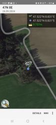
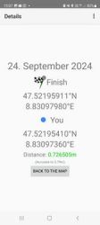
| Tue 24 Sep 2024 in 47,8: 47.5219591, 8.8309798 geohashing.info google osm bing/os kml crox |
Location
This Geohash is located in a forest between Gündlikon and Buch.
Participants
Plans
going there in my free afternoon if there's left enough time.
Expedition
This geohash seemed doable. But is there enough time for that? I have to finish the building application for my parents and other errands...
When everything was settled, I looked at the times on Google Maps and thought: it could be tight, but if the terrain is good on site it will be enough.
So overall it was a quick thing, but the location at the coordinates was wonderful. 20 minutes there and 20 minutes back after the visit by car.
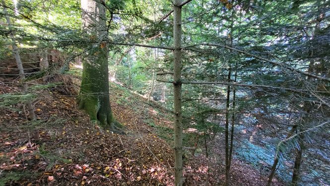
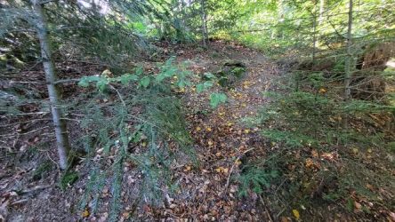
In between, I entered another world through the thicket at the edge of the forest. Lush green everywhere and slightly sloping terrain... ...but it got steeper and steeper and I saw a stream below that apparently had to be crossed! I passed a fox hole and luckily it had some logged wood that I could use as a bridge.
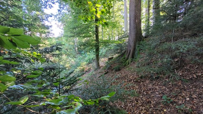
Over there it was a steep climb again to the coordinates. Everything looked simpler in the aerial photo... But the location was very nice! There should actually be a geocache here. I took a quick breather, then took my photos and then I had to go back. Time was running out. -> Speedrun
It was worth it! Success!
Photos

Way to go 1 / entering the forest

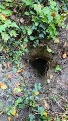
fox hole

Way to go 2 / down to the stream
there's my bridge
the geohash on the other side
The proof 1
The proof 2
north
west
south
east


Achievements
globescorer earned the Land geohash achievement
|
globescorer earned the Speedrun achievement
|