Difference between revisions of "2024-09-30 47 8"
Globescorer (talk | contribs) (Created page with "{{meetup graticule|date=2024-09-24|lat=47|lon=8}} ==Location== This Geohash is located in a forest between Gündlikon and Buch. ==Participants== *User:globescorer|globescor...") |
Globescorer (talk | contribs) (→Achievements) |
||
| (14 intermediate revisions by the same user not shown) | |||
| Line 1: | Line 1: | ||
| − | {{meetup graticule|date=2024-09- | + | {{meetup graticule|date=2024-09-30|lat=47|lon=8}} |
==Location== | ==Location== | ||
| − | This Geohash is located in a | + | This Geohash is located in a field near Katzenrüti. |
==Participants== | ==Participants== | ||
| Line 7: | Line 7: | ||
==Plans== | ==Plans== | ||
| − | going there in my | + | going there in my lunchtime. |
== Expedition == | == Expedition == | ||
| − | + | So I drove near the coordinates during my lunch time. A suitable parking space has already been found nearby in the aerial photo. From there it was only a short walk to the coordinates. I was lucky that the field was recently harvested (probably corn) and nothing new has been planted yet. During the short break I ate my lunch in the wonderful sunshine. An hour before it was raining heavily... Then I left the place for work again... ->Speedrun | |
| − | + | == Photos == | |
| − | + | <gallery mode="packed" heights="250px"> | |
| − | + | File:2024-09-30 47 8 site 2.jpg|View to the Geohash from the parking lot. (behind the street in the field) | |
| + | File:2024-09-30 47 8 way to go 1.jpg|approaching the hash. (behind the street in the field) | ||
| + | File:2024-09-30 47 8 The Geohash.jpg|The geohash | ||
| + | File:2024-09-30 47 8 proof 3.jpg|The proof 1 | ||
| + | File:2024-09-30 47 8 proof 2.jpg|The proof 2 | ||
| + | File:2024-09-30 47 8 south.jpg|south | ||
| + | File:2024-09-30 47 8 east.jpg|east | ||
| + | File:2024-09-30 47 8 north.jpg|north (the car on the left side is mine) | ||
| + | File:2024-09-30 47 8 west.jpg|west | ||
| + | File:2024-09-30 47 8 panorama.jpg |panorama | ||
| + | File:2024-09-30 47 8 selfie.jpg|selfie | ||
| + | File:2024-09-30 47 8 lunch.jpg|lunch at Geohash... | ||
| − | |||
| − | + | </gallery> | |
| − | == | + | == Proof of speedrun == |
| − | |||
| − | |||
| − | |||
| − | |||
<gallery mode="packed" heights="250px"> | <gallery mode="packed" heights="250px"> | ||
| − | File:2024-09- | + | File:2024-09-30 47 8 tracklog.jpg|tracklog / proof of speedrun |
| − | |||
| − | |||
| − | |||
| − | |||
| − | |||
| − | |||
| − | |||
| − | |||
| − | |||
| − | |||
</gallery> | </gallery> | ||
== Achievements == | == Achievements == | ||
{{#vardefine:ribbonwidth|100%}} | {{#vardefine:ribbonwidth|100%}} | ||
| − | {{land geohash|date=2024-09- | + | {{land geohash|date=2024-09-30|latitude=47|longitude=8|name=[[User:globescorer|globescorer]]|image=2024-09-30 47 8 The Geohash.jpg}} |
{{Speedrun achievement | {{Speedrun achievement | ||
| latitude = 47 | | latitude = 47 | ||
| longitude = 8 | | longitude = 8 | ||
| − | | date = 2024-09- | + | | date = 2024-09-30 |
| minutes = 55 | | minutes = 55 | ||
| name = [[User:globescorer|globescorer]] | | name = [[User:globescorer|globescorer]] | ||
}} | }} | ||
| + | {{Last man standing | latitude = 47 | longitude = 8 | date = 2024-09-30 | name = globescorer }} | ||
__NOTOC__ | __NOTOC__ | ||
Latest revision as of 06:15, 18 October 2024
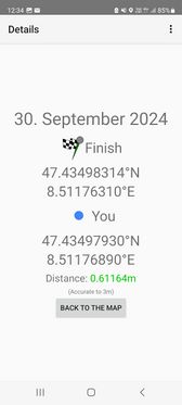
| Mon 30 Sep 2024 in 47,8: 47.4349831, 8.5117631 geohashing.info google osm bing/os kml crox |
Location
This Geohash is located in a field near Katzenrüti.
Participants
Plans
going there in my lunchtime.
Expedition
So I drove near the coordinates during my lunch time. A suitable parking space has already been found nearby in the aerial photo. From there it was only a short walk to the coordinates. I was lucky that the field was recently harvested (probably corn) and nothing new has been planted yet. During the short break I ate my lunch in the wonderful sunshine. An hour before it was raining heavily... Then I left the place for work again... ->Speedrun
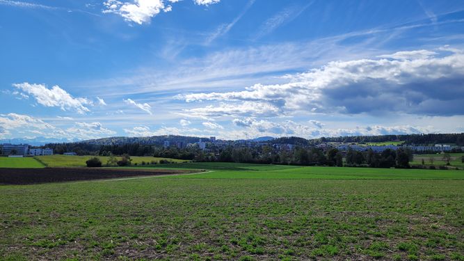
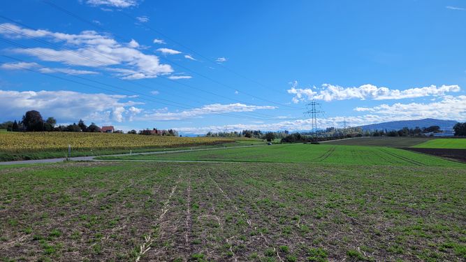
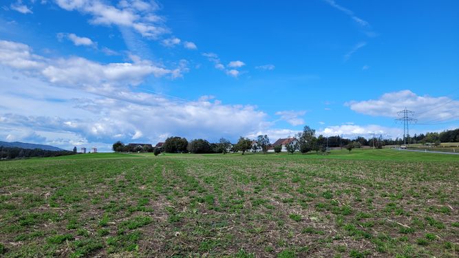
Photos
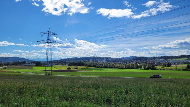
View to the Geohash from the parking lot. (behind the street in the field)

approaching the hash. (behind the street in the field)
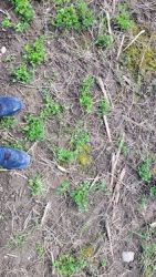
The geohash
The proof 1
The proof 2
south
east
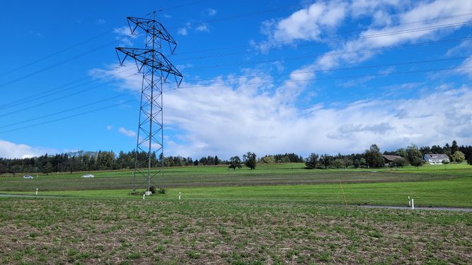
north (the car on the left side is mine)
west

panorama
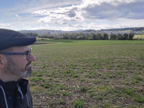
selfie
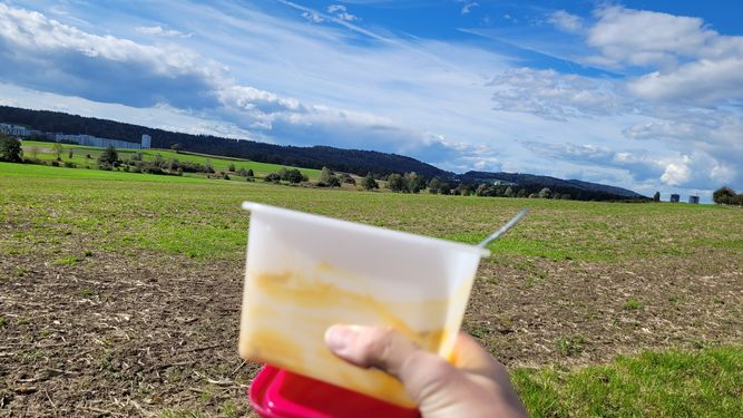
lunch at Geohash...


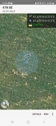
Proof of speedrun
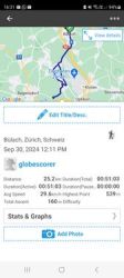
tracklog / proof of speedrun

Achievements
globescorer earned the Land geohash achievement
|
globescorer earned the Speedrun achievement
|
globescorer earned the Last man standing achievement
|