Difference between revisions of "2024-11-25 -37 144"
Felix Dance (talk | contribs) (An expedition message sent via Geohash Droid for Android.) |
|||
| (16 intermediate revisions by 2 users not shown) | |||
| Line 1: | Line 1: | ||
| − | + | [[Image:{{{image|2024-11-25_-37_144_Felix Dance _1732587963606.jpg}}}|thumb|left]] | |
| − | + | {{meetup graticule|date=2024-11-25|lat=-37|lon=144}} | |
| + | == Location == | ||
| + | On a footy oval in Lebanon Reserve, Strathmore. | ||
| + | |||
| + | == Participants == | ||
| + | Expedition 1: | ||
| + | *[[User:EdBordin|EdBordin]] | ||
| + | *Nellie | ||
| + | |||
| + | Expedition 2: | ||
| + | *Mitch | ||
| + | *Liam | ||
| + | |||
| + | Expedition 3: | ||
| + | *[[User:Mdixon4|Matt]] | ||
| + | |||
| + | Expedition 4: | ||
| + | *[[User:Felix Dance|Felix]] | ||
| + | *[[User:Johnwrw|John]] | ||
| + | *[[User:Pwc|Patrick]] | ||
| + | *[[User:Lachie|Lachie]] | ||
| + | *[[User:Cam_(2013)|Cam]] | ||
| + | *Peal | ||
| + | *[[User:Buckleyj|Joel]] | ||
| + | *Kate | ||
| + | *Carrington | ||
| − | + | Expedition 5 (unsuccessful): | |
| − | + | *BarbaraTables <!-- Left this un-hyperlinked so that it doesn't appear when I look for "my successful expeditions" --> | |
| − | + | == Expedition 1 == | |
| − | + | Ed and Nellie reached the hash in the miserable rain at 9:55am. Ed had to rush up Moreland Road Hill with Nellie on a single speed because he had a meeting. | |
| − | + | ||
| − | < | + | <gallery perrow="5"> |
| + | Image:2024-11-25_-37_144_Felix Dance _1732588971227.jpg|Ed and Nellie | ||
| + | </gallery> | ||
| − | == | + | == Expedition 2 == |
| − | + | Mitch and Liam reached the hash together at 6:06pm. | |
| − | |||
| − | = | + | <gallery perrow="5"> |
| − | + | Image:2024-11-25_-37_144_Felix Dance _1732588991415.jpg|Mitch and Liam | |
| − | + | Image:2024-11-25_-37_144_Felix Dance _1732589298984.jpg|Mitch GPS | |
| − | + | </gallery> | |
| − | == | + | == Expedition 3 == |
| − | + | Matt reached the hash at almost the same time as Mitch and Liam, at 6:19pm, but they did not meet. It was Liam's 2nd hash. | |
| − | |||
| − | |||
| − | |||
| − | |||
<gallery perrow="5"> | <gallery perrow="5"> | ||
| + | Image:2024-11-25_-37_144_Felix Dance _1732588998378.jpg|Matt | ||
</gallery> | </gallery> | ||
| − | == | + | == Expedition 4 == |
| − | + | We all met up along the route, with John riding from home to my (Felix's) place, Lachie riding from Fitzroy North and collecting Patrick and Pearl along the way, then us all meeting up in Brunswick West and riding the Moonee Ponds Creek rail trail to the hash in the evening murk. | |
| − | |||
| − | + | We had to climb a steep, muddy slope to get through an unlocked gate to access the hash-oval. Here we also met up with Cam. We took photos and screenshots to show we'd reached the hash. | |
| − | < | + | |
| − | + | We then met up with Joel, Kate and puppy Carrington who had walked from their Pascoe Vale home to meet us at the hash. Many beers were had by all. | |
| − | + | ||
| + | We then rode home in the dusk, peeling off in much the same way we'd coalesced. | ||
| + | |||
| + | <gallery perrow="5"> | ||
| + | |||
| + | Image:2024-11-25_-37_144_Felix Dance _1732587906506.jpg|The group coalesces | ||
| + | |||
| + | Image:2024-11-25_-37_144_Felix Dance _1732587925049.jpg|Climbing the slope | ||
| + | |||
| + | Image:2024-11-25_-37_144_Felix Dance _1732587939525.jpg|Me at the hash | ||
| + | |||
| + | Image:2024-11-25_-37_144_Felix Dance _1732588027331.jpg|GPS proof | ||
| + | |||
| + | Image:2024-11-25_-37_144_Felix Dance _1732588011782.jpg|Big group | ||
| + | |||
| + | Image:2024-11-25_-37_144_Felix Dance _1732587963606.jpg|More group | ||
| + | |||
| + | Image:2024-11-25_-37_144_Felix Dance _1732587979475.jpg|Dusk settles | ||
| + | |||
| + | Image:2024-11-25_-37_144_Felix Dance _1732587992466.jpg|The slope from below | ||
| + | </gallery> | ||
| − | + | Tracklog: | |
| − | |||
| − | |||
| − | |||
| − | + | {{ Tracklog | Lebanon Reserve geohash.gpx }} | |
| − | |||
| − | |||
| − | |||
| − | |||
| − | |||
| − | + | == Expedition 5 == | |
| − | |||
| − | -- | + | This was my second expedition for the day, with the one prior being the [[2024-11-25_-35_143|first successful expedition in the Swan Hill graticule]]. After traveling four hours from Kerang Station to Footscray Station, I took then the train to North Melbourne Station, then to Pascoe Vale Station. I then crossed a bridge, walked down the trail along the creek, and found that the oval was being used at this time of day. |
| − | |||
| − | |||
| − | |||
| − | |||
| − | + | I decided not to approach, making this a failed expedition. I wasn't worried though, because I was still very happy with today's achievement. | |
| − | |||
| − | + | <gallery heights="200px" mode="packed"> | |
| − | + | File:2024-11-25_-37_144_1.JPEG | |
| + | File:2024-11-25_-37_144_2.JPEG | ||
| + | File:2024-11-25_-37_144_3.JPEG | ||
| + | </gallery> | ||
| − | + | __NOTOC__ | |
| + | [[Category:New report]] | ||
| + | [[Category:Expeditions]] | ||
| + | [[Category:Expeditions with photos]] | ||
| + | [[Category:Coordinates reached]] | ||
Latest revision as of 08:59, 26 November 2024
| Mon 25 Nov 2024 in -37,144: -37.7269909, 144.9214530 geohashing.info google osm bing/os kml crox |
Location
On a footy oval in Lebanon Reserve, Strathmore.
Participants
Expedition 1:
- EdBordin
- Nellie
Expedition 2:
- Mitch
- Liam
Expedition 3:
Expedition 4:
Expedition 5 (unsuccessful):
- BarbaraTables
Expedition 1
Ed and Nellie reached the hash in the miserable rain at 9:55am. Ed had to rush up Moreland Road Hill with Nellie on a single speed because he had a meeting.
Expedition 2
Mitch and Liam reached the hash together at 6:06pm.
Expedition 3
Matt reached the hash at almost the same time as Mitch and Liam, at 6:19pm, but they did not meet. It was Liam's 2nd hash.
Expedition 4
We all met up along the route, with John riding from home to my (Felix's) place, Lachie riding from Fitzroy North and collecting Patrick and Pearl along the way, then us all meeting up in Brunswick West and riding the Moonee Ponds Creek rail trail to the hash in the evening murk.
We had to climb a steep, muddy slope to get through an unlocked gate to access the hash-oval. Here we also met up with Cam. We took photos and screenshots to show we'd reached the hash.
We then met up with Joel, Kate and puppy Carrington who had walked from their Pascoe Vale home to meet us at the hash. Many beers were had by all.
We then rode home in the dusk, peeling off in much the same way we'd coalesced.
Tracklog:
Expedition 5
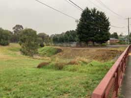
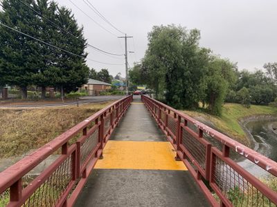
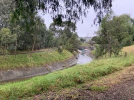
This was my second expedition for the day, with the one prior being the first successful expedition in the Swan Hill graticule. After traveling four hours from Kerang Station to Footscray Station, I took then the train to North Melbourne Station, then to Pascoe Vale Station. I then crossed a bridge, walked down the trail along the creek, and found that the oval was being used at this time of day.
I decided not to approach, making this a failed expedition. I wasn't worried though, because I was still very happy with today's achievement.


