Difference between revisions of "2008-06-07 49 -123"
From Geohashing
imported>NWoodruff |
m |
||
| (2 intermediate revisions by 2 users not shown) | |||
| Line 6: | Line 6: | ||
}} | }} | ||
| − | This was my first attempt at a Saturday hash. I had planned a long and challenging trip by transit, bicycle and foot to reach a remote, but accessible mountain geohash. Google showed a 20 km mountain road that led to within a kilometre of the hash. I was hoping it would be a good enough road to average 10 km an hour or so, and then I would walk/bushwhack the rest of the way. | + | This was my first attempt at a Saturday hash. I ([[User:Robyn|Robyn]]) had planned a long and challenging trip by transit, bicycle and foot to reach a remote, but accessible mountain geohash. Google showed a 20 km mountain road that led to within a kilometre of the hash. I was hoping it would be a good enough road to average 10 km an hour or so, and then I would walk/bushwhack the rest of the way. |
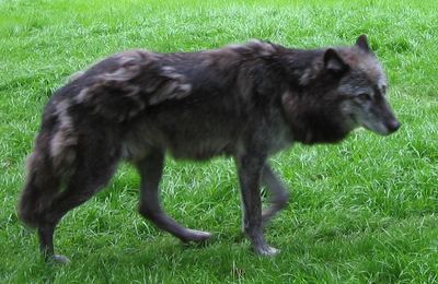
I got off the bus as a ski resort parking lot and started looking for the trail. First I found a trail that led to where there were wolves, but I was going in the wrong direction, so I turned around. | I got off the bus as a ski resort parking lot and started looking for the trail. First I found a trail that led to where there were wolves, but I was going in the wrong direction, so I turned around. | ||
| Line 22: | Line 22: | ||
[[Category:Not reached - No public access]] | [[Category:Not reached - No public access]] | ||
[[Category:Coordinates not reached]] | [[Category:Coordinates not reached]] | ||
| + | {{location|CA|BC|SL}} | ||
Latest revision as of 12:56, 19 March 2022
| Sat 7 Jun 2008 in 49,-123: 49.5017842, -123.1143708 geohashing.info google osm bing/os kml crox |
This was my first attempt at a Saturday hash. I (Robyn) had planned a long and challenging trip by transit, bicycle and foot to reach a remote, but accessible mountain geohash. Google showed a 20 km mountain road that led to within a kilometre of the hash. I was hoping it would be a good enough road to average 10 km an hour or so, and then I would walk/bushwhack the rest of the way.
I got off the bus as a ski resort parking lot and started looking for the trail. First I found a trail that led to where there were wolves, but I was going in the wrong direction, so I turned around.
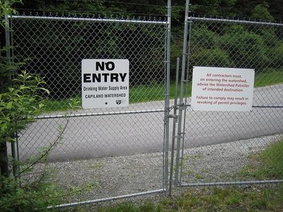
And then I found the most beautiful road imaginable, paved and everything, but behind this sign.
More details on my blog.

