Difference between revisions of "2009-04-13 51 10"
imported>Reinhard |
imported>Reinhard m |
||
| Line 29: | Line 29: | ||
| name=Manu and Reinhard | | name=Manu and Reinhard | ||
}} | }} | ||
| + | {{consecutive geohash | count=4 | latitude=50 | longitude=10 | date=2009-04-10 | name=Manu }} | ||
| + | {{consecutive geohash | count=3 | latitude=50 | longitude=10 | date=2009-04-11 | name=Reinhard }} | ||
[[Category:Expeditions]] | [[Category:Expeditions]] | ||
[[Category:Coordinates reached]] | [[Category:Coordinates reached]] | ||
Revision as of 11:59, 19 April 2009
| Mon 13 Apr 2009 in 51,10: 51.0737580, 10.8411838 geohashing.info google osm bing/os kml crox |
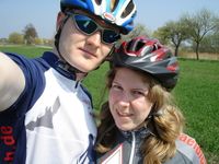
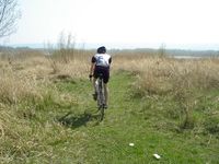
Like two days ago the weather was fantastic and the hash point was again only a bit more than 20 km to the place where we stayed this time in Erfurt, so we went on another bike trip, which would get Manu her 4th successful geohashing expedition in a row and me my 3rd.
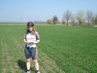
The terrain was quite flat this time and we could use several nice paved bike paths that got us quickly to the hash located in-between the small town of Dachwig and a lake. Luckily, the exact coordinates were only 30 m off the street that lead from Dachwig to the lake and though a tractor driver was working on the neighboring acre, we dismounted and walked the last few steps over the acre to that point. One more successful expedition and two happy geohashers!
After that, we surprised my sister's family in Dachwig by visiting them and eating all their cake and drinking all their beverages, including the coffee - thanks alot! Strengthened, we chose a more hilly way back home and followed an interesting bike path (completely new to me) along the A71 to Schaderode which lengthened the tour to a total of 65 km.
---Reinhard
- Photo Gallery
Awards
Manu and Reinhard earned the Bicycle geohash achievement
|
Manu earned the Consecutive geohash achievement
|
Reinhard earned the Consecutive geohash achievement
|
