Difference between revisions of "2009-04-17 48 -121"
imported>Robyn (I'm in a really evil mood today.) |
imported>Robyn (planning section done - rest tomorrow) |
||
| Line 16: | Line 16: | ||
* Robyn called 911 and asked for the police | * Robyn called 911 and asked for the police | ||
| − | == | + | ==Planning== |
| − | + | Robyn went geohashing [[2009-04-16 48 -122|yesterday]] and has a multihash planned for [[2009-04-18 49 -123|tomorrow]], so she wasn't really intending to geohash today. She was just clicking around to see what other people were doing. For example, it looked like Thomcat was planning to going to [[North Cascades National Park, Washington|North Cascades]] on [[Talk:Seattle, Washington#April 17-19|Saturday]]. Rats, Robyn wanted to be there for that, but you can't be everywhere. Robyn started clicking around to see if there was somewhere she could go on Sunday. The peeron app covers up the map scale with some links so she had to keep clicking back and forth to Google Maps to see how far things were. When she reloaded the peeron app the date reset to the 17th, and at first she didn't notice. What she did notice is that today's location in the North Cascades was pretty close to a road. Hmmm. And the terrain wasn't too high, so it probably wasn't snowbound. Hmmm. It was already one-thirty. And it was 218 km away. | |
| + | |||
| + | Robyn printed out directions, filled her water bottle, packed spare GPS batteries, thought about (but completely failed to find a way of) finding out if the back roads were open, grabbed T-Rex and called herself prepared. | ||
| + | |||
| + | ==Expedition== | ||
| + | Have to finish after tomorrow. | ||
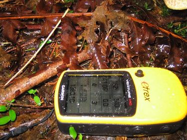
[[Image:2009-04-17 48 -121.gps.JPG|375 px]] | [[Image:2009-04-17 48 -121.gps.JPG|375 px]] | ||
Revision as of 05:17, 18 April 2009
| Fri 17 Apr 2009 in North Cascades, WA: 48.3262266, -121.5006527 geohashing.info google osm bing/os kml crox |
Location
This day's geohash for North Cascades National Park, Washington fell about 13 km northeast of the town of Darrington, Washington, between the Sauk River, in undeveloped, wooded land just west of Mt Baker National Forest.
True But Misleading Facts About the Expedition
- Robyn's low fuel indicator illuminated and Robyn did not make it to the next town on the remaining fuel.
- Robyn spent most of the expedition in an area where her cell phone displayed an Emergency Service Only message.
- When Robyn returned to the GPS coordinates where she had left her car, there was a burned out car carcass at the site.
- Robyn called 911 and asked for the police
Planning
Robyn went geohashing yesterday and has a multihash planned for tomorrow, so she wasn't really intending to geohash today. She was just clicking around to see what other people were doing. For example, it looked like Thomcat was planning to going to North Cascades on Saturday. Rats, Robyn wanted to be there for that, but you can't be everywhere. Robyn started clicking around to see if there was somewhere she could go on Sunday. The peeron app covers up the map scale with some links so she had to keep clicking back and forth to Google Maps to see how far things were. When she reloaded the peeron app the date reset to the 17th, and at first she didn't notice. What she did notice is that today's location in the North Cascades was pretty close to a road. Hmmm. And the terrain wasn't too high, so it probably wasn't snowbound. Hmmm. It was already one-thirty. And it was 218 km away.
Robyn printed out directions, filled her water bottle, packed spare GPS batteries, thought about (but completely failed to find a way of) finding out if the back roads were open, grabbed T-Rex and called herself prepared.
Expedition
Have to finish after tomorrow.
