Difference between revisions of "2009-08-02 49 -114"
imported>Elbie |
imported>Elbie (more) |
||
| Line 6: | Line 6: | ||
==Location== | ==Location== | ||
| − | On a | + | On a ranch near Lundbreck Falls |
==Participants== | ==Participants== | ||
| Line 23: | Line 23: | ||
Image:2009-08-02 49 -114 coulee2.jpg | Another coulee. | Image:2009-08-02 49 -114 coulee2.jpg | Another coulee. | ||
Image:2009-08-02 49 -114 pincherCreek.jpg | The Pincher Creek! | Image:2009-08-02 49 -114 pincherCreek.jpg | The Pincher Creek! | ||
| + | Image:2009-08-02 49 -114 feedlot.jpg | One of the many feedlots we passed. This is where your supermarket beef comes from (if you live in North America). If I showed you any more about these, you'd be making a turn for the vegetarian. | ||
| + | Image:2009-08-02 49 -114 lundbreck.jpg | We arrived in Lundbreck around 14:50; the foothills are ahead. | ||
| + | Image:2009-08-02 49 -114 foothills.jpg | And soon we were in the said foothills. | ||
| + | Image:2009-08-02 49 -114 falls.jpg | We made a stop at Lundbreck Falls. | ||
| + | Image:2009-08-02 49 -114 crowsnestRiver.jpg | The Crowsnest River, which is the source of the Lundbreck Falls. | ||
| + | Image:2009-08-02 49 -114 falls2.jpg | The falls. From here, we took a Range Road down to where the hashpoint was. | ||
| + | Image:2009-08-02 49 -114 windy.jpg | By the way, Alberta is windy. | ||
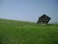
| + | Image:2009-08-02 49 -114 noTrespassing.jpg | The ranch upon the hashpoint fell was inaccessible. :( | ||
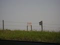
| + | Image:2009-08-02 49 -114 soClose.jpg | Closest we could get was about 200 metres. | ||
| + | Image:2009-08-02 49 -114 hashpoint.jpg | The hashpoint would be where the trees are. Beyond it are Angus cattle (future steaks), and windmills. | ||
</gallery> | </gallery> | ||
Revision as of 03:56, 4 August 2009
| Sun 2 Aug 2009 in 49,-114: 49.5333294, -114.1774206 geohashing.info google osm bing/os kml crox |
Contents
Location
On a ranch near Lundbreck Falls
Participants
- Elbie and her parents.
Expedition
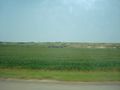
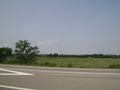
I set out with my parents in their car around 13:00. The terrain began pretty much like this: farms, with the occasional coulee.
Mostly, though, it was flat.
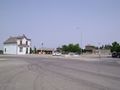
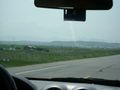
Soon we arrived in Fort Macleod, named after the fort to the right.
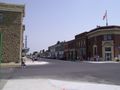
It's a small crap-town outside of Lethbridge, a small crap-city. Fort Mac is only really notable for its fort, its "historic" decrepit buildings, and being a filming site for Brokeback Mountain.
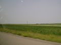
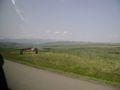
Leaving Fort Mac, there was more prairie!
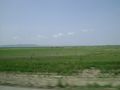
Sometimes the prairie even had cows on it!
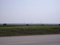
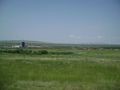
As we started to approach the foothills, we started seeing more windmills. These here provide energy for Calgary.
We then passed through the Blood Reserve, which makes up a large portion of the Pincher Creek graticule.
Another coulee.
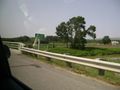
The Pincher Creek!
One of the many feedlots we passed. This is where your supermarket beef comes from (if you live in North America). If I showed you any more about these, you'd be making a turn for the vegetarian.
We arrived in Lundbreck around 14:50; the foothills are ahead.
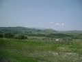
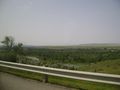
And soon we were in the said foothills.
We made a stop at Lundbreck Falls.
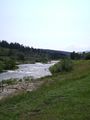
The Crowsnest River, which is the source of the Lundbreck Falls.
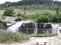
The falls. From here, we took a Range Road down to where the hashpoint was.
By the way, Alberta is windy.
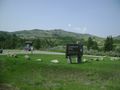
The ranch upon the hashpoint fell was inaccessible. :(
Closest we could get was about 200 metres.
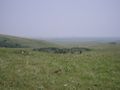
The hashpoint would be where the trees are. Beyond it are Angus cattle (future steaks), and windmills.


Ribbons
Pending