Difference between revisions of "2009-09-22 52 -0"
From Geohashing
imported>Joehardflec (→Photos) |
imported>Benjw m (remove unused image tags from ribbons) |
||
| Line 26: | Line 26: | ||
| name = [[User:Joehardflec|Joe Hardman]] | | name = [[User:Joehardflec|Joe Hardman]] | ||
| distance = 15.9km | | distance = 15.9km | ||
| − | |||
}} | }} | ||
| Line 36: | Line 35: | ||
will be completed later. | will be completed later. | ||
<gallery perrow="3"> | <gallery perrow="3"> | ||
| − | |||
Image:2009-09-22 52 -0 GPS.jpg | Witty Comment | Image:2009-09-22 52 -0 GPS.jpg | Witty Comment | ||
Image:2009-09-22 52 -0 Joe.jpg | Witty Comment | Image:2009-09-22 52 -0 Joe.jpg | Witty Comment | ||
Revision as of 17:12, 8 August 2010
| Tue 22 Sep 2009 in 52,-0: 52.5011038, -0.9968687 geohashing.info google osm bing/os kml crox |
Location
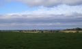
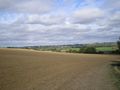
A field just outside of Gumley, with a footpath running through it.
Participants
Expedition
Joe walked this one, earning a
Joe Hardman earned the Walk geohash Achievement
|
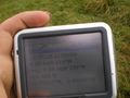
Tracklog
See gallery.
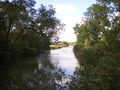
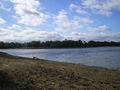
Photos
will be completed later.
Witty Comment

Witty Comment
Witty Comment
Witty Comment
Witty Comment
Witty Comment


