Difference between revisions of "2010-02-01 48 8"
From Geohashing
imported>Ekorren m (still only a template) |
imported>Ekorren (Gallery) |
||
| Line 19: | Line 19: | ||
<gallery perrow="4"> | <gallery perrow="4"> | ||
| + | File:2010-02-01_48_8_Ammertalbahn.jpg|Upper way for the lazy ones, lower one for the less lazy ones. | ||
| + | File:2010-02-01_48_8_Radfahrer_frei.jpg|<i>Bicyclists allowed until Hirschau and Wurmlingen</i>. This actually is the standard way, and there was nothing like a closure somewhere... | ||
| + | File:2010-02-01_48_8_Wurmlingen_1.jpg|Wurmlingen chapel | ||
| + | File:2010-02-01_48_8_Wurmlingen_2.jpg|Wurmlingen chapel again | ||
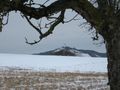
| + | File:2010-02-01_48_8_Heuberg.jpg|Random impressions | ||
| + | File:2010-02-01_48_8_Baeume.jpg | ||
| + | File:2010-02-01_48_8_Wald.jpg | ||
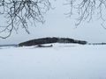
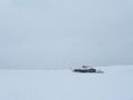
| + | File:2010-02-01_48_8_ViewOnHash.jpg|The hash is out there in the light gray | ||
| + | File:2010-02-01_48_8_Weg.jpg|Recommended bike trail | ||
| + | File:2010-02-01_48_8_GPS.jpg|Coordinates reached | ||
| + | File:2010-02-01_48_8_Marker.jpg|Kind of a marker | ||
| + | File:2010-02-01_48_8_View_from_hash_1.jpg|View from hash | ||
| + | File:2010-02-01_48_8_ViewFromHash_2.jpg|View from hash | ||
| + | File:2010-02-01_48_8_Bike.jpg|Bike waiting at the track | ||
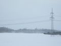
| + | File:2010-02-01_48_8_Neckartal.jpg|View into the Neckar valley | ||
</gallery> | </gallery> | ||
Revision as of 20:57, 1 February 2010
| Mon 1 Feb 2010 in 48,8: 48.4945115, 8.8367276 geohashing.info google osm bing/os kml crox |
Contents
Location
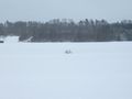
A white spot on a white field in a white world. Not far from Neustetten-Wolfenhausen.
Participants
Expedition
Photos
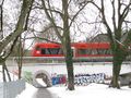
Upper way for the lazy ones, lower one for the less lazy ones.
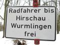
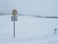
Bicyclists allowed until Hirschau and Wurmlingen. This actually is the standard way, and there was nothing like a closure somewhere...

Wurmlingen chapel
Wurmlingen chapel again
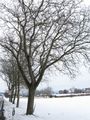
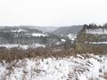
Random impressions
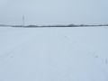
The hash is out there in the light gray
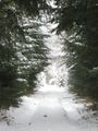
Recommended bike trail
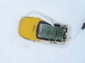
Coordinates reached
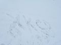
Kind of a marker
View from hash
View from hash
Bike waiting at the track
View into the Neckar valley


