Difference between revisions of "2010-04-18 50 11"
From Geohashing
imported>Reinhard (Created page with '{{subst:Expedition |lat = 50 |lon = 11 |date = 2010-04-18 }}') |
imported>Reinhard (report will follow) |
||
| Line 1: | Line 1: | ||
| − | |||
<!-- If you did not specify these parameters in the template, please substitute appropriate things for IMAGE, LAT, LON, and DATE (YYYY-MM-DD format) | <!-- If you did not specify these parameters in the template, please substitute appropriate things for IMAGE, LAT, LON, and DATE (YYYY-MM-DD format) | ||
| Line 15: | Line 14: | ||
__NOTOC__ | __NOTOC__ | ||
== Location == | == Location == | ||
| − | + | On the road between Magdala and Niedersynderstedt, close to Autobahn A4 exit Magdala. | |
== Participants == | == Participants == | ||
| − | + | * [[User:Manu|Manu]] | |
| + | * [[User:Reinhard|Reinhard]] | ||
== Plans == | == Plans == | ||
| Line 30: | Line 30: | ||
== Photos == | == Photos == | ||
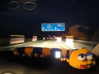
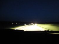
| − | + | {{gallery|width=200|height=200|lines=2 | |
| − | Image: | + | |Image:20100418-50N11E-01.jpg|. |
| − | -- | + | |Image:20100418-50N11E-02.jpg|. |
| − | + | }} | |
| − | |||
| − | |||
| − | |||
| − | |||
| − | |||
| − | |||
| − | |||
| − | |||
| − | |||
| − | |||
| − | |||
| − | |||
[[Category:Expeditions]] | [[Category:Expeditions]] | ||
| − | |||
[[Category:Expeditions with photos]] | [[Category:Expeditions with photos]] | ||
| − | |||
| − | |||
| − | |||
| − | |||
[[Category:Coordinates reached]] | [[Category:Coordinates reached]] | ||
| − | |||
| − | |||
| − | |||
| − | |||
| − | |||
| − | |||
| − | |||
| − | |||
| − | |||
| − | |||
Revision as of 06:34, 19 April 2010
| Sun 18 Apr 2010 in 50,11: 50.8919619, 11.4373027 geohashing.info google osm bing/os kml crox |
Location
On the road between Magdala and Niedersynderstedt, close to Autobahn A4 exit Magdala.
Participants
Plans
Expedition
Tracklog
Photos
|

