Difference between revisions of "2010-06-29 48 8"
imported>Ekorren m (cut&paste fail) |
imported>Ekorren (Gallery) |
||
| Line 21: | Line 21: | ||
== Gallery == | == Gallery == | ||
<gallery> | <gallery> | ||
| + | File:2010-06-29_48_8_Globe.jpg|With a proper map, nothing can go wrong. | ||
| + | File:2010-06-29_48_8_Busstop_Sign.jpg|Get off here | ||
| + | File:2010-06-29_48_8_Bus.jpg|Bus just about to hit the hashpoint | ||
| + | File:2010-06-29_48_8_GPS.jpg|Coordinates reached | ||
| + | File:2010-06-29_48_8_Hashpoint.jpg|Congestion at the hashpoint. The white car in front occupies the exact spot. | ||
| + | File:2010-06-29_48_8_B27.jpg|By car, I could have just followed federal highway 27 - I'm living just about 500m off that road. | ||
| + | File:2010-06-29_48_8_Endingen_Church.jpg|Small impression of hash village | ||
| + | File:2010-06-29_48_8_Plettenberg.jpg|Plettenberg from a distance | ||
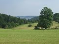
| + | File:2010-06-29_48_8_Lochenpass_Hills.jpg|Landscape impression up in the mountains | ||
| + | File:2010-06-29_48_8_HikingTrails.jpg|All ways lead to the Hörnle? At least five marked trails come along here. | ||
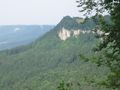
| + | File:2010-06-29_48_8_Schinderlucke_View.jpg|View from the Schinderlucke cliff | ||
| + | File:2010-06-29_48_8_Lochenstrasse.jpg|Three views on the road that took me up | ||
| + | File:2010-06-29_48_8_Hoernle_from_Schinderlucke.jpg|View on the Hörnle cliff | ||
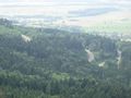
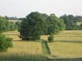
| + | File:2010-06-29_48_8_Hoernle_Hills_1.jpg|More landscape impressions to the hilly side | ||
| + | File:2010-06-29_48_8_Hoernle_Hills_2.jpg | ||
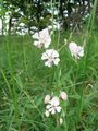
| + | File:2010-06-29_48_8_Hoernle_Flora.jpg | ||
| + | File:2010-06-29_48_8_Hoernle_View_2.jpg|View from the Hörnle cliff | ||
| + | File:2010-06-29_48_8_Hoernle_Biker.jpg|Other visitors. That's not me ;) | ||
| + | File:2010-06-29_48_8_Hoernle_Hiker.jpg|Neither that. This guy was 80 years old and still went hiking regularily | ||
| + | File:2010-06-29_48_8_Schinderlucke_from_Hoernle.jpg|View to the Schinderlucke cliff | ||
</gallery> | </gallery> | ||
Revision as of 11:01, 2 July 2010
| Tue 29 Jun 2010 in 48,8: 48.2566379, 8.8403584 geohashing.info google osm bing/os kml crox |
Location
At Balingen-Endingen, at the side of the B27 primary road, just a few metres behind bus stop "Krone" (=crown)
Participants
Expedition
Short version: Went there by train and bus and took a hike to the Hörnle (little horn) mountains afterwards. Great views from down there - photos will follow.
Gallery
With a proper map, nothing can go wrong.
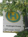
Get off here
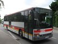
Bus just about to hit the hashpoint
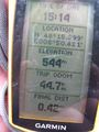
Coordinates reached
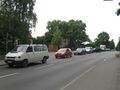
Congestion at the hashpoint. The white car in front occupies the exact spot.
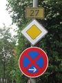
By car, I could have just followed federal highway 27 - I'm living just about 500m off that road.
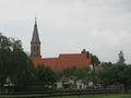
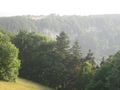
Small impression of hash village
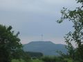
Plettenberg from a distance
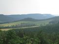
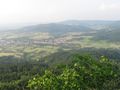
Landscape impression up in the mountains
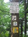
All ways lead to the Hörnle? At least five marked trails come along here.
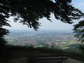
View from the Schinderlucke cliff
Three views on the road that took me up
View on the Hörnle cliff
More landscape impressions to the hilly side
View from the Hörnle cliff
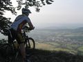
Other visitors. That's not me ;)
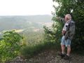
Neither that. This guy was 80 years old and still went hiking regularily
View to the Schinderlucke cliff


Achievements
- Consecutive geohash #5
- Deja Vu (without proof, but the bus line Balingen-Rottweil runs right through the hash and I can assure you, I've used that bus a few times)