Difference between revisions of "2010-07-11 40 -77"
imported>Rhonda m (→Achievements: cats) |
imported>Rhonda (→Returning: self-portrait) |
||
| Line 86: | Line 86: | ||
The buzzing tree was much quieter as I walked back toward the car. Whatever had annoyed the hive had stopped, I guess. I reset my GPS to find my apartment in York, just so I didn't have an arrow pointing backwards, turned around in a driveway again, and headed back the way I had come. I was planning on taking the directions google had given me on the way back so I could compare tracklogs, but I missed the turnoff and just followed 74 all the way back. When I compared the two routes on google maps at home, there was a 3-minute difference in travel time, and only a slight detour. | The buzzing tree was much quieter as I walked back toward the car. Whatever had annoyed the hive had stopped, I guess. I reset my GPS to find my apartment in York, just so I didn't have an arrow pointing backwards, turned around in a driveway again, and headed back the way I had come. I was planning on taking the directions google had given me on the way back so I could compare tracklogs, but I missed the turnoff and just followed 74 all the way back. When I compared the two routes on google maps at home, there was a 3-minute difference in travel time, and only a slight detour. | ||
| + | |||
| + | Then, just as I turned onto highway 30 to enter York, I realized that while I had taken a picture of Sophie, I hadn't taken a picture of myself, other than my forearm where my GPS was attached. Oops. Well, I wasn't about to drive two more hours for a single picture. I was hungry. Sophie was there, and she doesn't geohash without me. | ||
== Photos == | == Photos == | ||
Revision as of 01:39, 12 July 2010
| Sun 11 Jul 2010 in 40,-77: 40.1774056, -77.2872902 geohashing.info google osm bing/os kml crox |
Location
A lightly tree'd area just to the side of a golf course east of Carlisle.
Participants
Plans
Drive from York. Google tried to send me via Harrisburg and major highways, but the recommended bike route (despite not being something I will bike today) looked much prettier, as it goes via Gifford Pinchot State Park. I am assuming a state park that shows as green on satellite view will be pretty, since they usually are.
Expedition
I set out from the apartment I'm staying at in York mid-afternoon, with geohashing gear, hand-copied directions, a water bottle, and a couple of granola bars. Google promised me about an hour's drive each way, once I dragged the route away from the interstates and toward a country highway that went through a state park. Yeah, the interstate would have got me there faster, but it wouldn't have been as pretty. It's not like I had an appointment to keep or anything.
Driving
Following the directions went pretty well at first; I got on highway 30 and then 74. I had to make a bunch of turns in a town called Dillsburg, and come out the other side still on 74. The first one was a left, followed quickly by a right.
After a while on highway 74, I came to an intersection where the highway placard indicated that it turned left, but the intersection had no street names marked anywhere that I could see. I knew that I had to come out of the set of turns still on 74, so I crossed my fingers and made the turn.
There was no right turn shortly after.
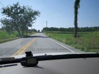
I had been expecting a series of a half dozen turns in quick succession after making that initial left, but here I was, driving through the countryside. Oh well, I was still on highway 74. Maybe google had taken me off 74 for a shortcut that involved more corners.
Ignoring my written directions and happily following the placards showing "74", I passed through a couple of small towns and more than a half dozen corners, crossed a level railroad crossing, passed a quaker meeting house and lots of cornfields, and then eventually spotted a sign for the next highway I had to change to, I-81. I was back on the route google had given me. I was, inevitably, on the interstate. At least only for a short time, instead of the entire hour of driving.
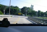
As I approached exit 44, the one google had instructed me to take, I saw a highway sign flash something about exit 44, then restart its cycle with "CAUTION CAUTION CAUTION". Fortunately I had enough time before I passed the sign for it to show me the rest of the message cycle. There was construction at exit 44. But, it didn't say the exit was closed, so I would take it anyway, even if I had to weave through an obstacle course of orange pylons.
It wasn't as bad as it could have been, but it was tight enough that I couldn't take a picture and drive through it at the same time.
Eventually I got myself turned in the right direction (yes, I took another wrong turn, and this time had to get turned around, while being followed by a big transport truck who was probably annoyed with how slowly and hesitantly I was driving as I looked for a place to do so. Judging by the fact that all I could see in my rearview mirror was its front grille.)
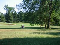
I turned onto the last named street on the google maps directions with 670m to go, and drove right through the middle of a golf course, on a road with no shoulder.
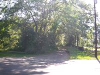
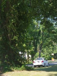
Some trees came up on the left, then a gap flashed by and then I was back into houses with the GPS pointing behind me, a car following me, and still no shoulder for me to pull over onto. Eventually a cross road appeared, and I got myself turned around using somebody's driveway, and headed back. Opposite the unnamed road, which in the brief glance I had got seemed to be a narrow gravel track, was a real street, so I decided before arriving at that intersection to park on the street opposite and walk the last bit. There was no shoulder, again, but at least around here there don't appear to be roadside ditches - I pulled the car off the road onto the edge of the grass. There was no fence at this point, but I was probably technically parked on the golf course.
Walking
I had parked just past a big tree, and as I walked past it I heard a buzzing noise. I paused and glanced up into the tree, and then my brain finished processing and identifying the sound. It was either a disturbed beehive, or a swarm. The agitated hum filled the air, and I realized that even though I couldn't spot the bees in the shadow of the tree's upper branches, they could probably see me looking at them. I walked away from the tree, glad the car windows were closed. An isolated buzz zoomed past my ear, but I wasn't otherwise pursued.
The gravel path had no signs indicating private property, ownership, or even where it went, so I walked down it, between the trees and a fence around the neighbouring yard.
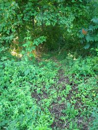
The trees were reasonably spaced apart, as I had guessed from the google maps aerial view. I had forgotten to check street view, however, and satellite view doesn't show underbrush. It was dense. There were thorns. It compared well to Vancouver's underbrush. And I still had 32m to go.
I decided that this wouldn't be my stupidity distance, because in addition to the underbrush and thorns, there was something else making me reluctant to enter: a cable from a power pole, going, as near as I could see, right to the ground, between me and the geohash. Now I didn't know if this was power, phone, or television, nor if it was live, but I didn't want to find out.
Fortunately, this was a narrow outthrust of trees between the path I was on and the golf course. I decided to try from the golf course side.
The underbrush was just as thick on this side, and because I'd turned off the camera's flash yesterday while museuming, the photo of an impressive set of thistles ended up blurry from camera shake. I kept going, trying to find the closest approach. 27m - better. I went a few steps farther, then paused, and looked again at the underbrush. Or rather, the lack thereof: there was a distinct path. Did golfers always lose balls in this particular spot? I looked at the golf course. No, I wasn't near the flag, but near the starting pad. Oh well. In we go.
There were prickly plants at my ankles and crunchy twigs underfoot and lots of spiderwebs at face height. I managed to spot most of them before getting a face full of web, and only walked into one.
At the hashpoint
I wasn't moving fast enough for my GPS to reliably show me a direction, so I just headed inward, watching for decreasing numbers instead of looking at the arrow. As usual under trees, the GPS kept jumping around. Eventually I found a small clearing where the GPS read just over 3m long enough for me to photograph it before jumping back to 16m away from the point. Since its accuracy under the trees ranged from 6m to 10m, I decided that a bit over 3.5m was just fine to declare this one achieved.
Near the clearing was what would have been a dead-end stream if it had water in it. Sadly, it was full of garbage instead. Maybe that's why the trail was there. Sophie went for a walk in what were from her perspective tall thin trees, then we took some pictures of the area and left. The granola bar which I had been intending to eat was very squishy, so I decided to just be a bit hungry on the way back. This is why I don't buy chocolate, peanut butter, or yoghurt coated granola bars.
Returning
As I was picking my way toward the golf course again, I heard a loud crack followed by some swearing and displeased muttering. Must be golfers. They had moved partway toward the flag by the time I got out of the underbrush, and didn't see me.
The buzzing tree was much quieter as I walked back toward the car. Whatever had annoyed the hive had stopped, I guess. I reset my GPS to find my apartment in York, just so I didn't have an arrow pointing backwards, turned around in a driveway again, and headed back the way I had come. I was planning on taking the directions google had given me on the way back so I could compare tracklogs, but I missed the turnoff and just followed 74 all the way back. When I compared the two routes on google maps at home, there was a 3-minute difference in travel time, and only a slight detour.
Then, just as I turned onto highway 30 to enter York, I realized that while I had taken a picture of Sophie, I hadn't taken a picture of myself, other than my forearm where my GPS was attached. Oops. Well, I wasn't about to drive two more hours for a single picture. I was hungry. Sophie was there, and she doesn't geohash without me.
