Difference between revisions of "2010-11-20 34 -83"
imported>NWoodruff (→NWoodruff) |
imported>NWoodruff (→Gallery) |
||
| Line 31: | Line 31: | ||
<gallery caption="Photo Gallery" widths="200px" heights="200px" perrow="3"> | <gallery caption="Photo Gallery" widths="200px" heights="200px" perrow="3"> | ||
| − | Image:2010112034-83NW01.jpg | | + | Image:2010112034-83NW01.jpg | 2.06 feet to go. Close enough. |
| + | Image:2010112034-83NW02.jpg | Time of the meetup. | ||
| + | Image:2010112034-83NW03.jpg | Date of the meetup. | ||
| + | Image:2010112034-83NW04.jpg | 14 feet accuracy. | ||
| + | Image:2010112034-83NW05.jpg | Looking North Standing on the Geohash spot. | ||
| + | Image:2010112034-83NW06.jpg | looking West up the hill towards the road. | ||
| + | Image:2010112034-83NW07.jpg | Me with my sister as a drag along. | ||
| + | Image:2010112034-83NW08.jpg | Looking East down the hill standing on the Geohash spot. | ||
</gallery> | </gallery> | ||
Revision as of 02:51, 23 November 2010
| Sat 20 Nov 2010 in Toccoa: 34.1520055, -83.5408657 geohashing.info google osm bing/os kml crox |
Graticule
About
Off of County Farm Road in Jefferson.
Expedition
NWoodruff
In a bizarre twist of fate, I agreed to go on a bicycle ride for today that passes 500 feet or so from this Geohash spot. I've been a big fan of this bicycle club and am going to ride this route Apple Valley Loop. It will pass by the hash point so close as I will have to stop.
I am a fan of long distance riding as you can see here. I am looking forward to today's ride.
I found the geohash spot with 1.25 feet to go. I took a few pictures and then continued on my way.
The ride can be found here
Gallery
- Photo Gallery
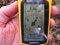
2.06 feet to go. Close enough.
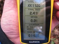
Time of the meetup.
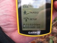
Date of the meetup.
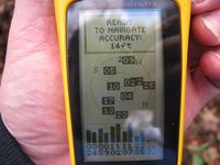
14 feet accuracy.
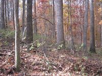
Looking North Standing on the Geohash spot.
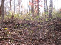
looking West up the hill towards the road.
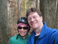
Me with my sister as a drag along.
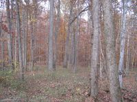
Looking East down the hill standing on the Geohash spot.


Achievements
NWoodruff earned the Land geohash achievement
|
Nathan earned the Bicycle geohash achievement
|