Difference between revisions of "2010-11-26 46 -123"
From Geohashing
imported>Aperfectring (→Plans) |
imported>Aperfectring ([live picture] On the road, driving through the rain. [http://www.openstreetmap.org/?lat=45.7850&lon=-122.8730&zoom=16&layers=B000FTF @45.7850,-122.8730]) |
||
| Line 38: | Line 38: | ||
--> | --> | ||
<gallery perrow="5"> | <gallery perrow="5"> | ||
| + | |||
| + | Image:2010-11-26_46_-123_13-53-02-670.jpg | On the road, driving through the rain. [http://www.openstreetmap.org/?lat=45.7850&lon=-122.8730&zoom=16&layers=B000FTF @45.7850,-122.8730] | ||
</gallery> | </gallery> | ||
Revision as of 21:52, 26 November 2010
| Fri 26 Nov 2010 in 46,-123: 46.1211388, -123.0334835 geohashing.info google osm bing/os kml crox |
Location
Looks to be under some high-tension power lines near the Columbia River, up near Rainier, OR.
Participants
Plans
Jiml will stop by APR's place, with two dogs, at about noon. They will grab a quick lunch, and then head off to the hashpoint, for expedition fun in the 45F (7C) rainy weather that is a typical Oregon November day.
Expedition
Tracklog
Photos
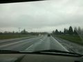
On the road, driving through the rain. @45.7850,-122.8730

Achievements