Difference between revisions of "2010-12-12 47 8"
imported>TheOneRing |
imported>TheOneRing (→Photos) |
||
| Line 16: | Line 16: | ||
== Photos == | == Photos == | ||
| − | + | <gallery perrow="5"> | |
| + | Image:20101212Train1.jpg|The train to Bassersdorf | ||
| + | Image:20101212TrainStation.jpg|The train station of Bassersdorf | ||
| + | Image:MeplusFlag.jpg|Me at the geohash (Swiss flag in the background) | ||
| + | Image:20101212hashpoint.jpg|The tripod marks the geohash (or maybe it is the Apple tree) | ||
| + | Image:20101212GPS.jpg|The proof that I reached the right coordinates... | ||
| + | Image:20101212Date.jpg|...at the right date | ||
| + | Image:20101212SwissFlag.jpg|A great Flag of Switzerland at the geohash | ||
| + | Image:20101212Surrounding.jpg|The hill where the geohash is located | ||
| + | Image:20101212Train2.jpg|The train back to Zürich | ||
| + | </gallery> | ||
| + | |||
== Achievements == | == Achievements == | ||
{{land geohash | latitude = 47 | longitude = 8 | date = 2010-12-12 | name = TheOneRing}} | {{land geohash | latitude = 47 | longitude = 8 | date = 2010-12-12 | name = TheOneRing}} | ||
Revision as of 16:27, 12 December 2010
| Sun 12 Dec 2010 in 47,8: 47.4447425, 8.6258899 geohashing.info google osm bing/os kml crox |
The Place
The geohash is in Bassersdorf near Zürich.
Who Went
TheOneRing - by public transport.
The Expedition
The OneRing
I decided to go by train to Zürich, Switzerland and from there with another train to Bassersdorf. The village itself is near the airport "Zürich-Kloten" which I recognized immediately, because every minute a plane was starting and flew over me. After arriving at the train station in Bassersdorf the geohash was approx. 2km in side te village. On the way I saw a cat but it ran away from me so I could not pet it. Finally the geohash was located on a hill, not on top but on a hillside. It was marked with a great flag of Switzerland, which stand 5m next to the geohash. The countryside was not very attractive and after taking the usual photos I left the place.
Photos
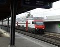
The train to Bassersdorf
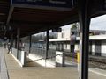
The train station of Bassersdorf

Me at the geohash (Swiss flag in the background)
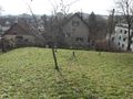
The tripod marks the geohash (or maybe it is the Apple tree)
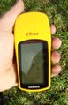
The proof that I reached the right coordinates...
...at the right date
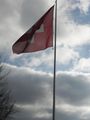
A great Flag of Switzerland at the geohash
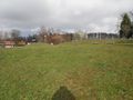
The hill where the geohash is located
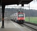
The train back to Zürich


Achievements
TheOneRing earned the Land geohash achievement
|
TheOneRing earned the Public transport geohash achievement
|
TheOneRing achieved level 1 of the Minesweeper Geohash achievement
|