Difference between revisions of "2011-01-30 34 -85"
imported>Turbomagnus |
imported>Jiml m (Fix result codes, again) |
||
| Line 47: | Line 47: | ||
provided proof that even in places you wouldn't expect it, you can still experience nature's touch. | provided proof that even in places you wouldn't expect it, you can still experience nature's touch. | ||
| − | |||
== Photos == | == Photos == | ||
| − | + | ||
| − | |||
| − | |||
<gallery perrow="4"> | <gallery perrow="4"> | ||
Image:Turbo_and_hashcot.JPG|Chibithulu the hashcot is the one without the Stupid Grin. | Image:Turbo_and_hashcot.JPG|Chibithulu the hashcot is the one without the Stupid Grin. | ||
| Line 63: | Line 60: | ||
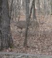
Image:MidrangeEncounter.JPG|One of three deer we saw on the way out... If other cars hadn't been so loud and scared them off, we'd have had better pictures. | Image:MidrangeEncounter.JPG|One of three deer we saw on the way out... If other cars hadn't been so loud and scared them off, we'd have had better pictures. | ||
</gallery> | </gallery> | ||
| + | |||
| + | |||
| + | == Achievements == | ||
{{land geohash | {{land geohash | ||
| Line 88: | Line 88: | ||
by reaching the hashpoint without using a GPS | by reaching the hashpoint without using a GPS | ||
}} | }} | ||
| + | |||
| + | |||
| + | |||
| + | [[Category:Expeditions]] | ||
| + | [[Category:Expeditions with photos]] | ||
| + | [[Category:Coordinates reached]] | ||
Revision as of 23:31, 30 January 2011
| Sun 30 Jan 2011 in 34,-85: 34.9377187, -85.2592357 geohashing.info google osm bing/os kml crox |
Location
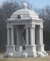
In the middle of Lafayette Rd. near a Florida monument and some cannons in Chickamauga National Battlefield
Participants
Plans
turbomagnus 16:05, 30 January 2011 (EST): Not yet owning a GPS, my hashing abilities are limited, but as a regular visitor to Chickamauga and with such visible landmarks nearby, I was fairly certain that I wouldn't need one to come within a reasonable distance of the hashpoint.
Expedition
turbomagnus 16:19, 30 January 2011 (EST): Along with my hashcot and a drag-along I was watching for the weekend, we pulled out of the driveway around twelve-thirty local time and made our way west to the hashpoint. Upon arrival at the location, pictures were taken of myself and hashcot, approximate location of the hashpoint itself, surrounding landmarks and geohashing marker (complete with rather embarassing spelling mistake. Mea culpa.). Evidence of humanity's presence was found in the form of a cold-weather glove left abandoned in the field next to the nearby monument to Florida's participation in the Battle of Chickamauga. Drag-along recieved an impromptu lesson on the history of the battlefield and associated ghost stories.
Aforementioned geohashing marker was left in the form of 'XCKD' (sic. Silly me.) written on the edge of the road in white chalk.
Indirect return route took us through the battlefield where we experienced a mid-range encounter of the wildlife kind in the form of a small herd of deer in the woods on the side of one of the battlefield's secondary roads. Due to distance and traffic, only one picture proved viable, but provided proof that even in places you wouldn't expect it, you can still experience nature's touch.
Photos
Achievements
turbomagnus earned the Land geohash achievement
|
turbomagnus earned the Drag-along achievement
|
| turbomagnus
by reaching the hashpoint without using a GPS earned the No Batteries Geohash Achievement
|


