Difference between revisions of "2011-05-11 41 -74"
From Geohashing
imported>Jabib ([retro picture] Not sure if the Android app will add the geotag data from the image or the current gps data since I'm not posting from the hash location. [http://www.openstreetmap.org/?lat=41.0161&lon=-74.5543&zoom=16&layers=B000FTF @41.0161,-74.5543) |
imported>Jiml m (Add details) |
||
| Line 1: | Line 1: | ||
| − | |||
<!-- If you did not specify these parameters in the template, please substitute appropriate values for IMAGE, LAT, LON, and DATE (YYYY-MM-DD format) | <!-- If you did not specify these parameters in the template, please substitute appropriate values for IMAGE, LAT, LON, and DATE (YYYY-MM-DD format) | ||
| Line 15: | Line 14: | ||
}} | }} | ||
| − | + | ||
__NOTOC__ | __NOTOC__ | ||
== Location == | == Location == | ||
| Line 21: | Line 20: | ||
== Participants == | == Participants == | ||
| − | + | ||
| + | * Jabib | ||
== Plans == | == Plans == | ||
<!-- what were the original plans --> | <!-- what were the original plans --> | ||
| + | |||
| + | Unknown | ||
| + | |||
== Expedition == | == Expedition == | ||
<!-- how it all turned out. your narrative goes here. --> | <!-- how it all turned out. your narrative goes here. --> | ||
| − | + | Unknown, but they appear to have reached it. | |
| − | + | ||
| + | |||
== Photos == | == Photos == | ||
| − | + | ||
| − | |||
| − | |||
<gallery perrow="5"> | <gallery perrow="5"> | ||
| Line 43: | Line 45: | ||
== Achievements == | == Achievements == | ||
{{#vardefine:ribbonwidth|800px}} | {{#vardefine:ribbonwidth|800px}} | ||
| − | |||
| + | * Land Geohash | ||
| − | |||
| − | |||
| − | |||
| − | + | [[Category:Expeditions]] | |
| − | |||
| − | [[Category: | ||
| − | |||
| − | |||
| − | |||
| − | |||
[[Category:Expeditions with photos]] | [[Category:Expeditions with photos]] | ||
| − | + | ||
| − | |||
| − | |||
| − | |||
| − | |||
[[Category:Coordinates reached]] | [[Category:Coordinates reached]] | ||
| − | |||
| − | |||
| − | |||
| − | |||
| − | |||
| − | |||
| − | |||
| − | |||
| − | |||
| − | |||
Revision as of 05:11, 23 May 2011
| Wed 11 May 2011 in 41,-74: 41.0160713, -74.5543678 geohashing.info google osm bing/os kml crox |
Location
Participants
- Jabib
Plans
Unknown
Expedition
Unknown, but they appear to have reached it.
Photos
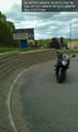
Not sure if the Android app will add the geotag data from the image or the current gps data since I'm not posting from the hash location. @41.0161,-74.5543

Achievements
- Land Geohash