Difference between revisions of "2011-07-03 39 -76"
From Geohashing
imported>Eldin m (fix typo and clean up template.) |
imported>FippeBot m (Location) |
||
| Line 63: | Line 63: | ||
[[Category:Expeditions with photos]] | [[Category:Expeditions with photos]] | ||
[[Category:Coordinates reached]] | [[Category:Coordinates reached]] | ||
| + | {{location|US|MD|AN}} | ||
Latest revision as of 06:58, 9 August 2019
| Sun 3 Jul 2011 in 39,-76: 39.1440572, -76.5689717 geohashing.info google osm bing/os kml crox |
Location
Freetown, MD
Participants
Expedition
Route: B/W Parkway to MD Rt. 100 East to Mountain Rd. to Freetown Rd.
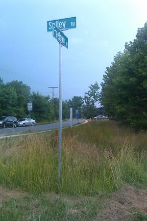
Mission accomplished at 7:08 PM. Hash point was within a few meters of the street sign for the intersection of Solley Rd. and Freetown Rd.
Weather was thunderstormy.
Photos
Achievements
1000miles1stStep earned the Land geohash achievement
|
1000miles1stStep issued a challenge for the Tale of Two Hashes achievement
|


