Difference between revisions of "2011-07-06 44 -107"
From Geohashing
imported>NWoodruff (Undocumented/forgotten expedition) |
imported>NWoodruff (→Gallery) |
||
| Line 28: | Line 28: | ||
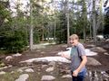
Image:2011-07-06_44_-107_startofwalk.jpg | Start of Walk | Image:2011-07-06_44_-107_startofwalk.jpg | Start of Walk | ||
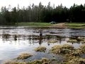
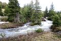
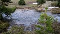
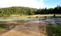
Image:2011-07-06_44_-107_stream.jpg | Stream | Image:2011-07-06_44_-107_stream.jpg | Stream | ||
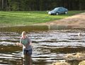
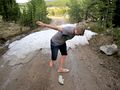
| − | Image:2011-07-06_44_-107_thumbsup.jpg | | + | Image:2011-07-06_44_-107_thumbsup.jpg | When I stopped to take a picture of the stream, my sister came and posed. So, this is her giving an enthusiastic thumbs up to the stream that prevented us from reaching the point. |
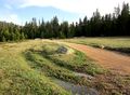
Image:2011-07-06_44_-107_windingroad.jpg | Winding Road | Image:2011-07-06_44_-107_windingroad.jpg | Winding Road | ||
</gallery> | </gallery> | ||
| + | |||
== Achievements == | == Achievements == | ||
Revision as of 19:41, 25 April 2012
| Wed 6 Jul 2011 in Worland: 44.6230991, -107.4071567 geohashing.info google osm bing/os kml crox |
Gallery
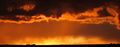
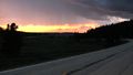
Sunset
Closed
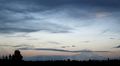
Clouds
Cold
Flipflop
Fording
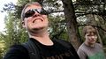
Goofing
Hello Stream
It's Fast
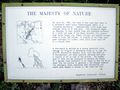
Majesty
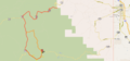
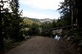
Map
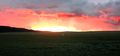
More Sunset
More Water
Over there
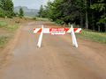
Road Blocked
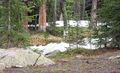
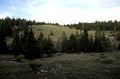
Start of Walk
Stream
When I stopped to take a picture of the stream, my sister came and posed. So, this is her giving an enthusiastic thumbs up to the stream that prevented us from reaching the point.
Winding Road


