Difference between revisions of "2011-07-26 46 6"
From Geohashing
imported>Crox (plan) |
imported>Crox (pictures, reached) |
||
| Line 1: | Line 1: | ||
| − | |||
| − | |||
| − | |||
| − | |||
| − | |||
| − | |||
| − | |||
| − | |||
| − | |||
{{meetup graticule | {{meetup graticule | ||
| lat=46 | | lat=46 | ||
| Line 14: | Line 5: | ||
}} | }} | ||
| − | + | ||
__NOTOC__ | __NOTOC__ | ||
== Location == | == Location == | ||
| Line 32: | Line 23: | ||
== Photos == | == Photos == | ||
| − | + | {{#vardefine:gaLines|3}} | |
| − | + | {{#vardefine:gaWidth|250}} | |
| − | -- | + | {{#vardefine:gaHeight|230}} |
| − | + | {{Gallery2| | |
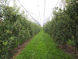
| − | + | {{GalleryItem | File:2011-07-26_46_6_01-view-IMG_1097.JPG | view towards the hash }} | |
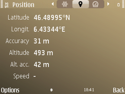
| + | {{GalleryItem | File:2011-07-26_46_6_02-gps1-Screenshot0023.png | coordinates reached }} | ||
| + | {{GalleryItem | File:2011-07-26_46_6_03-gps2-Screenshot0025.png | coordinates reached }} | ||
| + | {{GalleryItem | File:2011-07-26_46_6_04-hash-IMG_1099.JPG | the hash }} | ||
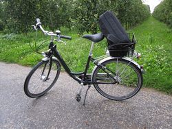
| + | {{GalleryItem | File:2011-07-26_46_6_05-bike-IMG_1103.JPG | how I got there }} | ||
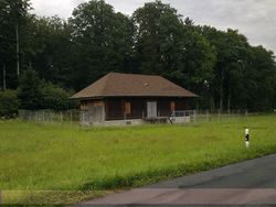
| + | {{GalleryItem | File:2011-07-26_46_6_06-chalet-26072011280.jpg | "chalet" near the hash }} | ||
| + | }} | ||
== Achievements == | == Achievements == | ||
| Line 43: | Line 40: | ||
| − | |||
| − | |||
| − | |||
| − | |||
| − | |||
| − | |||
| − | |||
| − | |||
| − | |||
[[Category:Expeditions]] | [[Category:Expeditions]] | ||
| − | |||
[[Category:Expeditions with photos]] | [[Category:Expeditions with photos]] | ||
| − | |||
| − | |||
| − | |||
| − | |||
| − | |||
[[Category:Coordinates reached]] | [[Category:Coordinates reached]] | ||
| − | |||
| − | |||
| − | |||
| − | |||
| − | |||
| − | |||
| − | |||
| − | |||
| − | |||
| − | |||
Revision as of 21:27, 26 July 2011
| Tue 26 Jul 2011 in 46,6: 46.4899497, 6.4334210 geohashing.info google osm bing/os kml crox |
Location
in an orchard near Etoy
Participants
Plans
bike-sharing from Morges, ETA 18:30
Expedition
Tracklog
Photos
|


